524
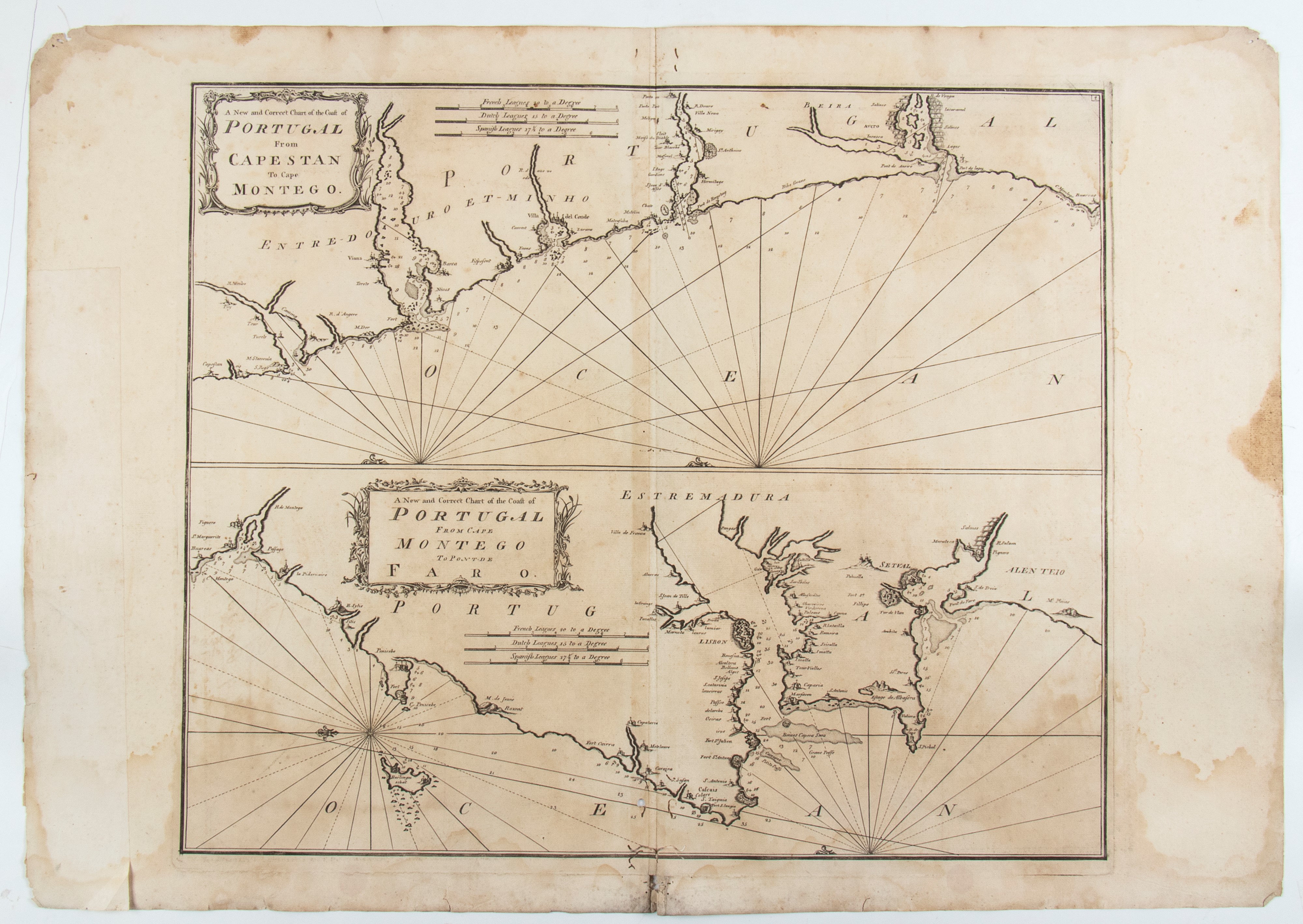
A new and correct chart of the coast of Portugal from Cape Stan to Cape Montego | A new and correct chart of the coast of Portugal from Cape Montego to Pont de Faro
Mappa della costa portoghese tratta da "A complete set of new charts on thirty-eight large plates containing an accurate survey of the coast of Portugal and the Mediterranean sea in which are included seventy-five charts".
Acquaforte e bulino, 610 x 870 mm circa. Stampata su carta vergata, con consueta piega editoriale. Carta brunita, con alcune macchie, fori e usure lungo i margini. Un pezzo di carta è incollato sul margine sinistro. Al verso, iscrizione manoscritta di antica mano.
Provenienza: Vecchia Marina Antiquariato Navale, Roma
Asta Live 316
Stampe antiche e moderne, disegni e carte geografiche
Palazzo Caetani Lovatelli, gio 14 Novembre 2024
TORNATA UNICA 14/11/2024 Ore 12:00