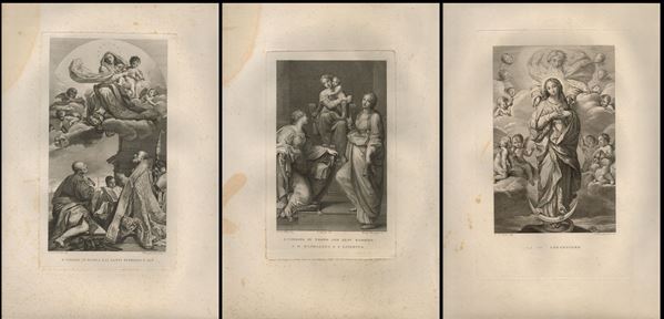
361
Francesco Rosaspina
(1762 - 1841)
3 engravings
engraving, 485 x 325 mm (each sheet), B. VERGINE IN GLORIA E LI SANTI PETRONIO E ALO after Giacomo Cavedone, LA [..]
361
Francesco Rosaspina
(1762 - 1841)
3 engravings
engraving, 485 x 325 mm (each sheet), B. VERGINE IN GLORIA E LI SANTI PETRONIO E ALO after Giacomo Cavedone, LA [..]
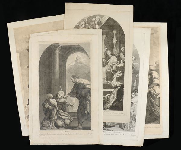
362
Giuliano Traballesi
(1727 - 1812)
5 engravings
engravings, approx. 50 x 30 cm each. S. Anna/ S. Martino in atto di fare l'Elemosina an un Povero/ Quadro di Mattia [..]
362
Giuliano Traballesi
(1727 - 1812)
5 engravings
engravings, approx. 50 x 30 cm each. S. Anna/ S. Martino in atto di fare l'Elemosina an un Povero/ Quadro di Mattia [..]
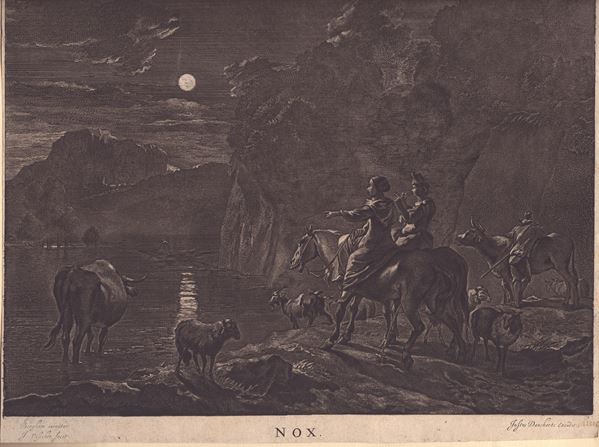
363
Johannes Visscher
(1633 - 1712)
Nox
Engraving, etching and acquatint, 314 x 367 mm. Published by Justus Danckertsz in ca. 1660. Well inked impression [..]
363
Johannes Visscher
(1633 - 1712)
Nox
Engraving, etching and acquatint, 314 x 367 mm. Published by Justus Danckertsz in ca. 1660. Well inked impression [..]
365
Thomas Ryder
(1746 - 1810)
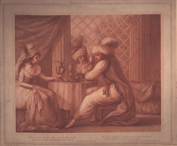
The beautiful stranger poisoned by her sister
1878
after a painting by Henry William Bunbury. Etching and stipple in sepia ink, 315 x 365 mm (sheet). Fine impression [..]
365
Thomas Ryder
(1746 - 1810)
The beautiful stranger poisoned by her sister
1878
after a painting by Henry William Bunbury. Etching and stipple in sepia ink, 315 x 365 mm (sheet). Fine impression [..]
366
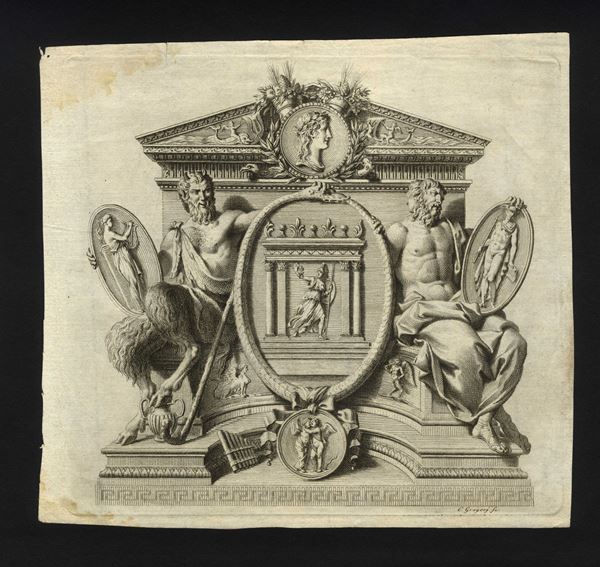
Carlo Bartolomeo Gregori
(1702 - 1759)
Decorative cartouche with temple and various deities, ornamental medallions and friezes
etching, 19.5 x 18 cm. Printed on ivory paper, trimmed. In good general condition, with a slight stain on the [..]
366
Carlo Bartolomeo Gregori
(1702 - 1759)
Decorative cartouche with temple and various deities, ornamental medallions and friezes
etching, 19.5 x 18 cm. Printed on ivory paper, trimmed. In good general condition, with a slight stain on the [..]
367
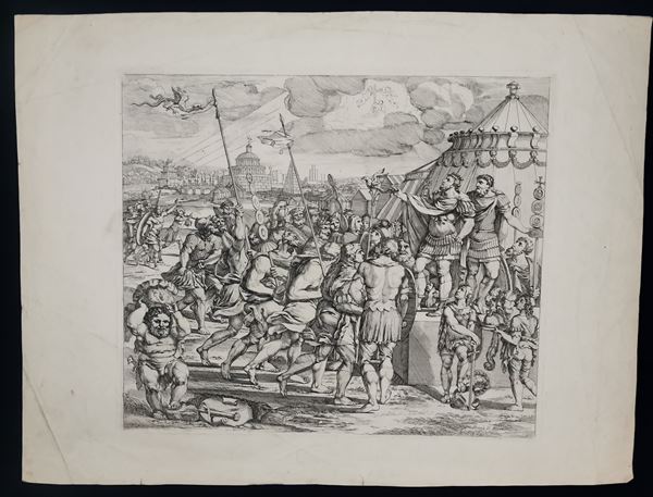
Domenico Mucci
(1857 - 1866)
Apparition of the Cross to Constantine
after Giulio Romano's frescoes in Loggie di Raffaello in the Vatican. Etching, 44.5x33.5 cm. Inscribed on the [..]
367
Domenico Mucci
(1857 - 1866)
Apparition of the Cross to Constantine
after Giulio Romano's frescoes in Loggie di Raffaello in the Vatican. Etching, 44.5x33.5 cm. Inscribed on the [..]
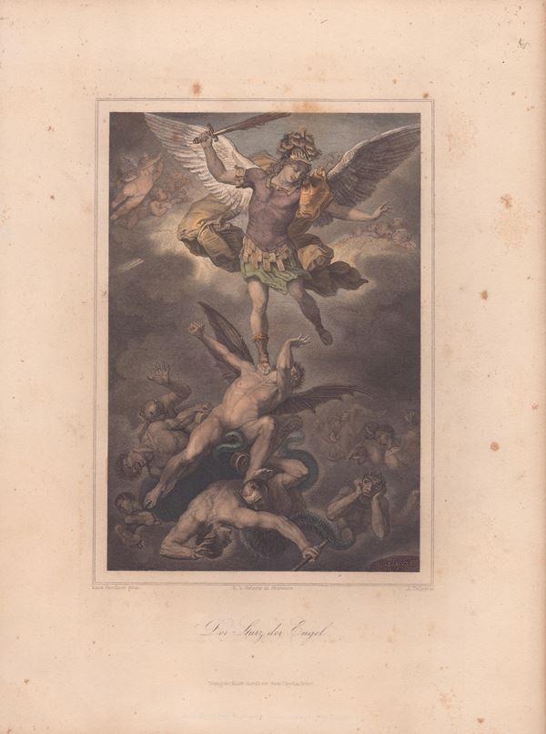
368
A. Volkert by Luca Giordano -- Fall of the Angels
1860
engraving, coloured, with passe-partout, 21.5 x 13.5 cm
368
A. Volkert by Luca Giordano -- Fall of the Angels
1860
engraving, coloured, with passe-partout, 21.5 x 13.5 cm
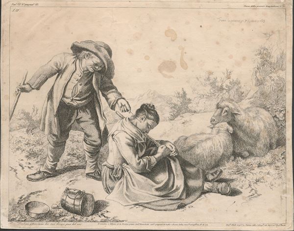
369
Francesco Londonio
(Milano, 1723 - 1783)
A sleeping shepherdess and a shepherd
1782
etching, 196 x 250 mm; sheet applied to a support, stains and defects, Scola n. 44
369
Francesco Londonio
(Milano, 1723 - 1783)
A sleeping shepherdess and a shepherd
1782
etching, 196 x 250 mm; sheet applied to a support, stains and defects, Scola n. 44
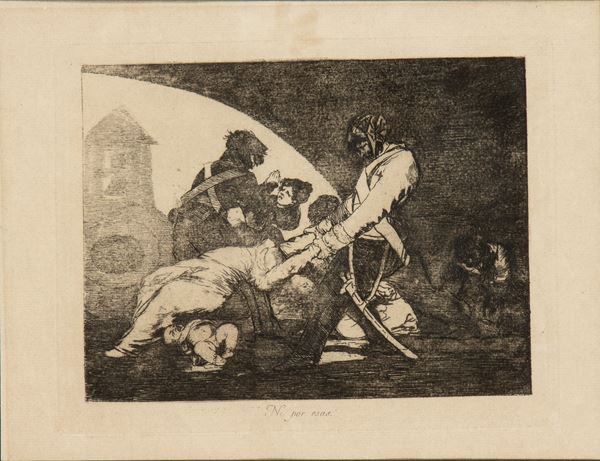
370
Francisco Goya
(1746 - 1828)
Not exactly
etching and aquatint, 16 x 20 cm (plate), 21 x 26.5 cm (sheet). Printed on laid paper. Complete sheet, light oxidation. [..]
370
Francisco Goya
(1746 - 1828)
Not exactly
etching and aquatint, 16 x 20 cm (plate), 21 x 26.5 cm (sheet). Printed on laid paper. Complete sheet, light oxidation. [..]
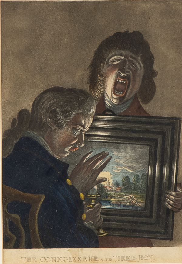
371
Henry Morland
(1716 - 1797)
After
The Connoisseur and Tired Boy
mezzotint, 24.5 x 17 cm. Nice impression. It has not been examined out of frame (34 x 27 x 2 cm).
371
Henry Morland
(1716 - 1797)
After
The Connoisseur and Tired Boy
mezzotint, 24.5 x 17 cm. Nice impression. It has not been examined out of frame (34 x 27 x 2 cm).
372
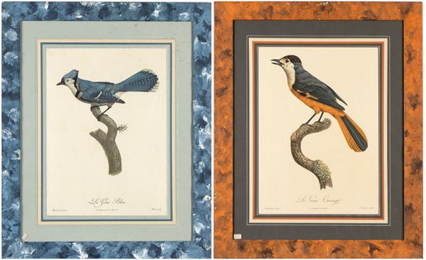
Jacques Louis Pérée
(1769 - 1832)
Le Geai Bleu | Le Geai Orangé
Lotto di 2 litografie, 37 x 26 cm cad. Bellissime impressioni su carta vergata. Foglio intonsi in ottime condizioni [..]
372
Jacques Louis Pérée
(1769 - 1832)
Le Geai Bleu | Le Geai Orangé
Lotto di 2 litografie, 37 x 26 cm cad. Bellissime impressioni su carta vergata. Foglio intonsi in ottime condizioni [..]
373
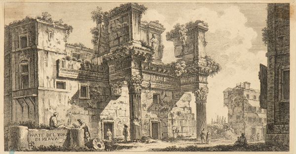
Giovanni Battista Piranesi
(Mogliano Veneto, 1720 - Venezia, 1778)
Based on
Parte del Foro di Nerva
etching, 151 x 282 mm, mirror copy of Piranesi's etching from the 'Antichità Romane' series, one of the series [..]
373
Giovanni Battista Piranesi
(Mogliano Veneto, 1720 - Venezia, 1778)
Based on
Parte del Foro di Nerva
etching, 151 x 282 mm, mirror copy of Piranesi's etching from the 'Antichità Romane' series, one of the series [..]
374
Francesco Bartolozzi
(1728 - 1815)
Harlequin as a lacemaker
1760
after Giovanni Domenico Ferretti, engraving and etching, 404 x 280 mm, fine impression on laid paper, trimmed, [..]
374
Francesco Bartolozzi
(1728 - 1815)
Harlequin as a lacemaker
1760
after Giovanni Domenico Ferretti, engraving and etching, 404 x 280 mm, fine impression on laid paper, trimmed, [..]
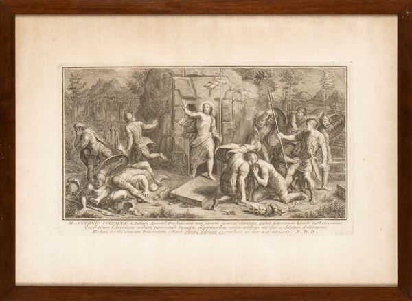
375
The Resurrection
after Raffaello, engraving, 42 x 59 cm, fineimpression on laid paper, sheet in very good condition except for [..]
375
The Resurrection
after Raffaello, engraving, 42 x 59 cm, fineimpression on laid paper, sheet in very good condition except for [..]
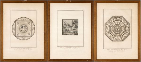
376
Roman mosaics
Lot of 3 engravings, 48 x 32 cm (plate); 61.5 x 45.5 cm (sheet). fINEimpressions, sheets in good condition, [..]
376
Roman mosaics
Lot of 3 engravings, 48 x 32 cm (plate); 61.5 x 45.5 cm (sheet). fINEimpressions, sheets in good condition, [..]
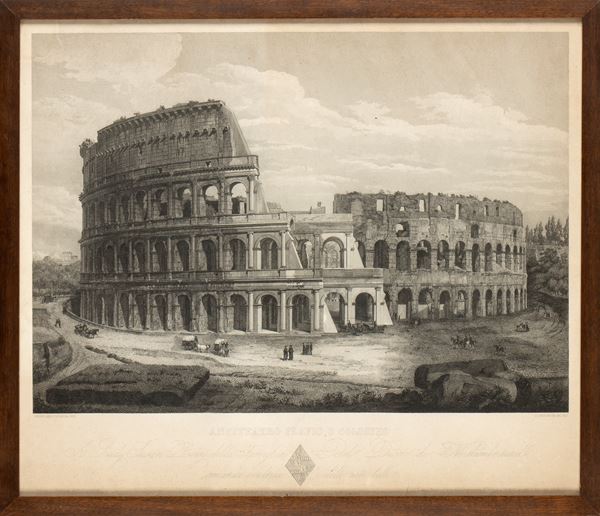
377
Domenico Amici
(1808)
Anfiteatro Flavio o Colosseo
engraving, 45 x 52 cm, oxidized paper, with frame and glass
377
Domenico Amici
(1808)
Anfiteatro Flavio o Colosseo
engraving, 45 x 52 cm, oxidized paper, with frame and glass
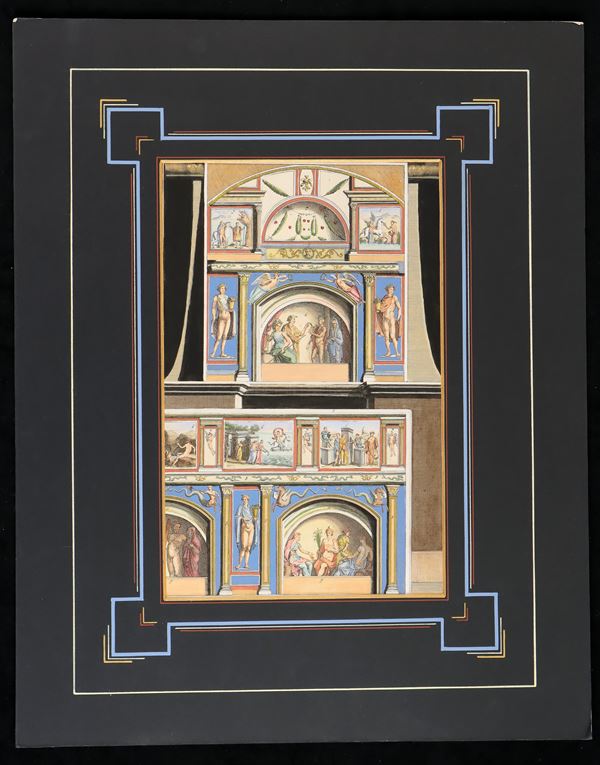
378
Divisionum quae sunt in capitae camerae sepulcralis
etching, 387 x 247 mm. Plate taken from ROMA SUBTERRANEA NOVISSIMA. Fine coeval coloring in Pompeian style. [..]
378
Divisionum quae sunt in capitae camerae sepulcralis
etching, 387 x 247 mm. Plate taken from ROMA SUBTERRANEA NOVISSIMA. Fine coeval coloring in Pompeian style. [..]
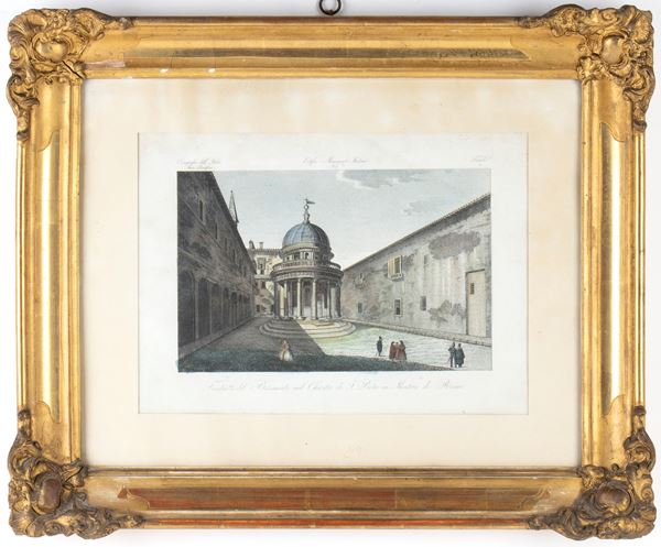
379
Tempietto del Bramante nel Chiostro di S. Pietro in Montorio di Roma
with gilt frame (47 x 57 x 5 cm). The print has not been examined out of frame, engraving, 180 x 280 mm (image)
379
Tempietto del Bramante nel Chiostro di S. Pietro in Montorio di Roma
with gilt frame (47 x 57 x 5 cm). The print has not been examined out of frame, engraving, 180 x 280 mm (image)
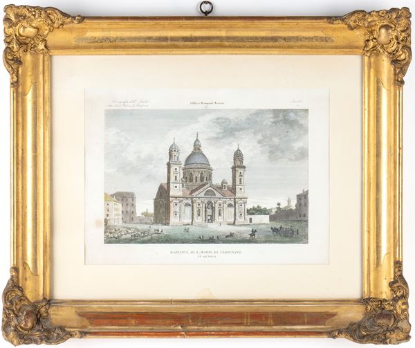
380
Basilica of S. Maria di Carignano in Genoa
nineteenth century
with gilt frame (47 x 57 x 5 cm). The print has not been examined out of frame, engraving, 195 x 285 mm (image)
380
Basilica of S. Maria di Carignano in Genoa
nineteenth century
with gilt frame (47 x 57 x 5 cm). The print has not been examined out of frame, engraving, 195 x 285 mm (image)
381
Willibald Schulmeister
(1851 - 1909)
Due litografie floreali
40,5 x 31,5 cad. stampate a Vienna da Gerlach & Schenk, carta uniformante brunita con lieve sgualciature
381
Willibald Schulmeister
(1851 - 1909)
Due litografie floreali
40,5 x 31,5 cad. stampate a Vienna da Gerlach & Schenk, carta uniformante brunita con lieve sgualciature
382
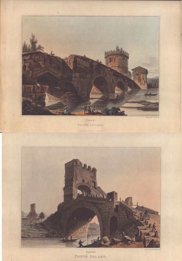
Matthew Dubourg
(1806)
PONTE SALARO | PONTE LUCANO (Rome)
1820
lithograph, 315 x 405 mm (each sheet). Nice impressions. Sheets in very good condition.
382
Matthew Dubourg
(1806)
PONTE SALARO | PONTE LUCANO (Rome)
1820
lithograph, 315 x 405 mm (each sheet). Nice impressions. Sheets in very good condition.
383
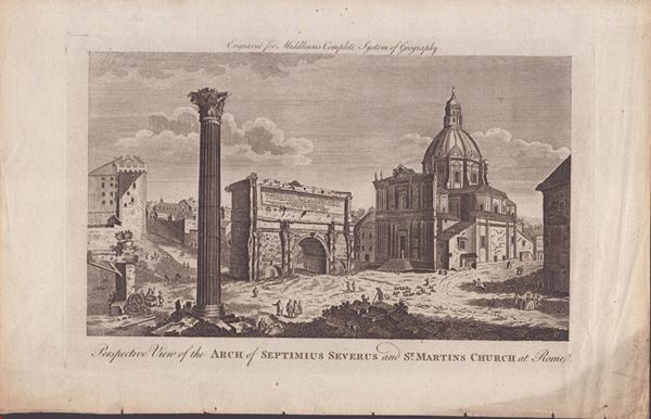
Perspective View of the Arch of Septimus Severus and St. Martins Church at Rome
engraving, 235 x 363 mm (sheet). Print on thin laid paper. Sheet in good condition except for oxidation and creases [..]
383
Perspective View of the Arch of Septimus Severus and St. Martins Church at Rome
engraving, 235 x 363 mm (sheet). Print on thin laid paper. Sheet in good condition except for oxidation and creases [..]
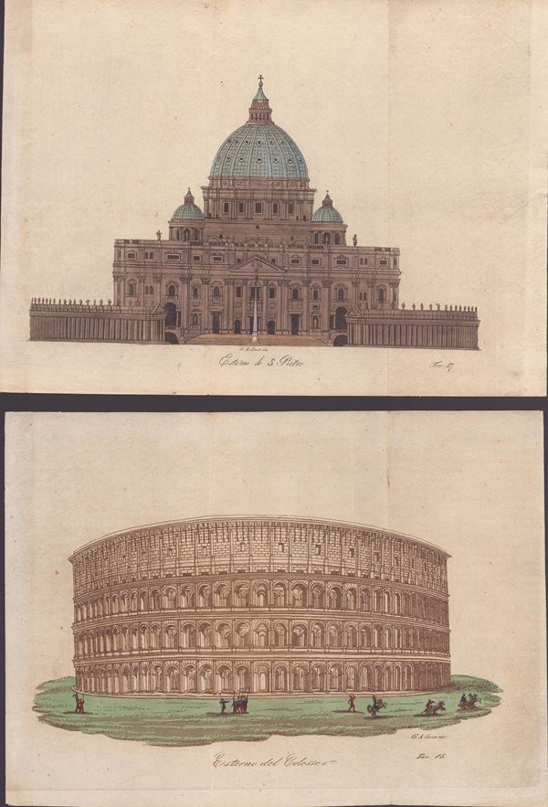
384
Giovanni Antonio Sasso
(1816)
Exterior of S. Pietro | Colosseum exterior
lithograph, approx. 205 x 280 mm (each sheet), printed on thin unlaid paper. Sheets in excellent condition except [..]
384
Giovanni Antonio Sasso
(1816)
Exterior of S. Pietro | Colosseum exterior
lithograph, approx. 205 x 280 mm (each sheet), printed on thin unlaid paper. Sheets in excellent condition except [..]
385
Lot of 4 engravings depicting monuments of Rome
various sizes, each with frame, glass and passepartout
385
Lot of 4 engravings depicting monuments of Rome
various sizes, each with frame, glass and passepartout
386
Lot of 15 engravings depicting the monuments and places of Rome
1. SECTION OF THE TIBER IN FACE OF THE FALCONIERI PALACE Etching, 34 x 24.5 cm 2. Giovanni Battista Falda [..]
386
Lot of 15 engravings depicting the monuments and places of Rome
1. SECTION OF THE TIBER IN FACE OF THE FALCONIERI PALACE Etching, 34 x 24.5 cm 2. Giovanni Battista Falda [..]
387
Lot of 5 engravings
Giovanni Acquaroni, Internal view of the Pantheon, 1826. Burin and etching, 42 x 56 cm. Good condition, signs [..]
387
Lot of 5 engravings
Giovanni Acquaroni, Internal view of the Pantheon, 1826. Burin and etching, 42 x 56 cm. Good condition, signs [..]
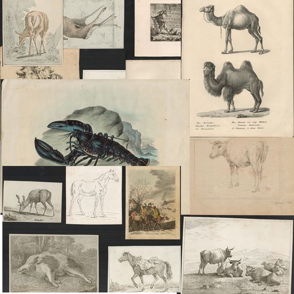
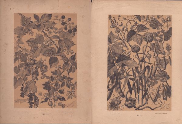
388
Lot of 22 prints depicting animals
various techniques, measurements from 13 x 15 cm to 26 x 38 cm max, good condition
388
Lot of 22 prints depicting animals
various techniques, measurements from 13 x 15 cm to 26 x 38 cm max, good condition
389
Rome. Lot of 8 engravings
engravings, approx. 31 x 42 cm. (sheet). From the series COROGRAFIA DELL' ITALIA STATO PONTIFICIO. Very good [..]
389
Rome. Lot of 8 engravings
engravings, approx. 31 x 42 cm. (sheet). From the series COROGRAFIA DELL' ITALIA STATO PONTIFICIO. Very good [..]
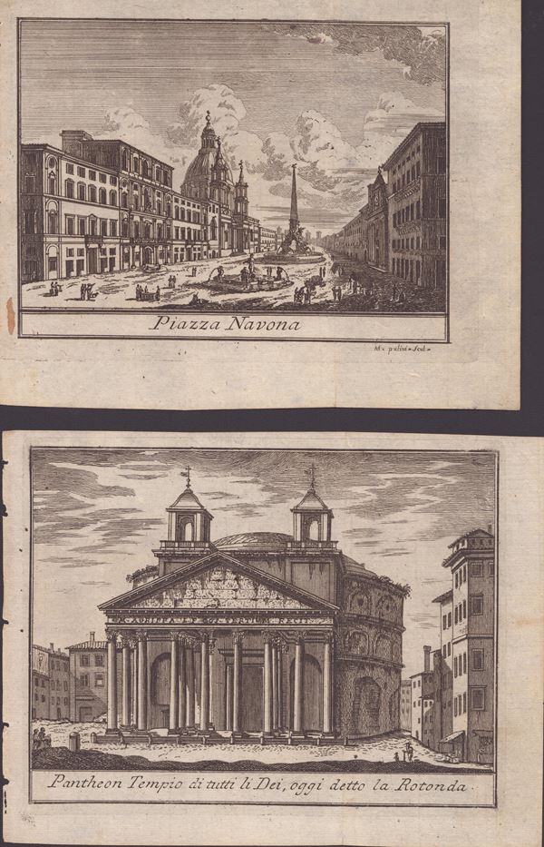
390
Lotto di 17 incisioni con vedute di Roma
XVII-XVIII secolo
acquaforte, 16 x 20 cm ca. (cad. foglio). Belle impressioni su carta vergata sottile. In buono stato generale.
390
Lotto di 17 incisioni con vedute di Roma
XVII-XVIII secolo
acquaforte, 16 x 20 cm ca. (cad. foglio). Belle impressioni su carta vergata sottile. In buono stato generale.
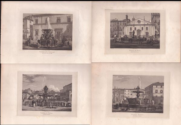
391
Domenico Amici
(1808)
Fountains of Rome
1840 ca.
Lot of 4 prints. Engravings and etchings, 30.5 x 44 cm each. Very good state of preservation.
391
Domenico Amici
(1808)
Fountains of Rome
1840 ca.
Lot of 4 prints. Engravings and etchings, 30.5 x 44 cm each. Very good state of preservation.
392
Lot of 10 engravings depicting churches and basilicas of Rome
etching, approx. 17 x 14 cm each Each with frame, glass and passe-partout (30 x 28 x 2 cm). Good overall condit [..]
392
Lot of 10 engravings depicting churches and basilicas of Rome
etching, approx. 17 x 14 cm each Each with frame, glass and passe-partout (30 x 28 x 2 cm). Good overall condit [..]
393
Domenico Pronti
(1750 - 1815)
Lot of 16 engravings with Roman views
Etching, approx. 8 x 12 cm each. With frames and glass (16 x 20 x 2 cm). Good overall condition.
393
Domenico Pronti
(1750 - 1815)
Lot of 16 engravings with Roman views
Etching, approx. 8 x 12 cm each. With frames and glass (16 x 20 x 2 cm). Good overall condition.
394
Lot of 8 engravings with Roman views
1830 ca.
etchings, approx. 8 x 12 cm Taken from "New collection of the main ancient and modern views of the ancient city [..]
394
Lot of 8 engravings with Roman views
1830 ca.
etchings, approx. 8 x 12 cm Taken from "New collection of the main ancient and modern views of the ancient city [..]
395
Antonio Carbonati
(1893 - 1956)
Cannareggio Canal – Venice
1922
lithograph, 31x44 cm. Printed on beige paper, complete sheet with small tear restored at the bottom on the right [..]
395
Antonio Carbonati
(1893 - 1956)
Cannareggio Canal – Venice
1922
lithograph, 31x44 cm. Printed on beige paper, complete sheet with small tear restored at the bottom on the right [..]
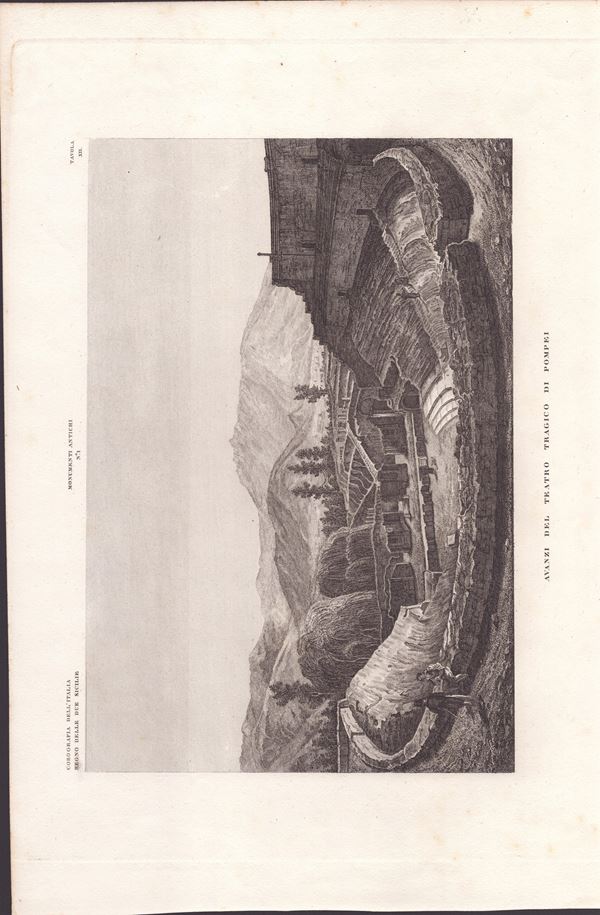
396
Pompeii. Lot of 8 engravings
engraving, approx. 31 x 42 cm (sheet). From the series COROGRAFIA DELL' ITALIA REGNO DELLE DUE SICILIE. Very good [..]
396
Pompeii. Lot of 8 engravings
engraving, approx. 31 x 42 cm (sheet). From the series COROGRAFIA DELL' ITALIA REGNO DELLE DUE SICILIE. Very good [..]
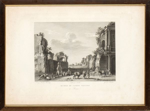
397
Ruins of Campo Vaccino in Rome
engraving, 42 x 58 cm, signs of foxing and oxidation, with frame and glass
397
Ruins of Campo Vaccino in Rome
engraving, 42 x 58 cm, signs of foxing and oxidation, with frame and glass
398
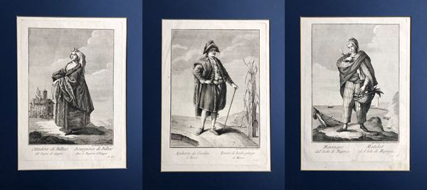
Teodoro Viero
(1740 - 1819)
Sailor from the Island of Majorca | Apaltor of the Gardens of Murcia | City of Bilbao in the Kingdom of Spain
Lot of 3. Engraving and etching, approx. 27.5 x 20 cm. (each plate), approx. 38 x 26 cm (each sheet). Fine, fresh [..]
398
Teodoro Viero
(1740 - 1819)
Sailor from the Island of Majorca | Apaltor of the Gardens of Murcia | City of Bilbao in the Kingdom [..]
Lot of 3. Engraving and etching, approx. 27.5 x 20 cm. (each plate), approx. 38 x 26 cm (each sheet). Fine, fresh [..]
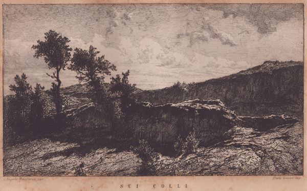
399
Angelo Beccaria
(1820 - 1879)
On the hills
Etching, 14.1 x 21 cm (plate); 20.5 x 29 cm (sheet). Published by Carlo Lovera (1869-1886 (fl)). Printed on wove [..]
399
Angelo Beccaria
(1820 - 1879)
On the hills
Etching, 14.1 x 21 cm (plate); 20.5 x 29 cm (sheet). Published by Carlo Lovera (1869-1886 (fl)). Printed on wove [..]
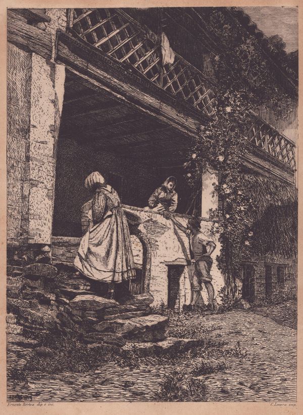
400
Ernesto Bertea
(1836 - 1904)
Biella architecture
Etching, 30.7 x 19 cm. State II of 2. Published by Carlo Lovera (1869-1886 (fl)). Giubbini 5. Print on wove paper. [..]
400
Ernesto Bertea
(1836 - 1904)
Biella architecture
Etching, 30.7 x 19 cm. State II of 2. Published by Carlo Lovera (1869-1886 (fl)). Giubbini 5. Print on wove paper. [..]