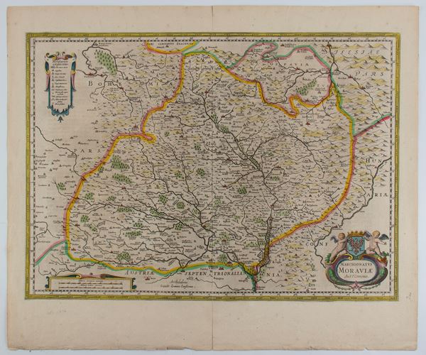
480
Peter Schenk
(1660 - 1713)
Marchionatus Moraviae Auct. I. Comenio
Amsterdam, circa 1700
Etching and engraving, 495 x 592 mm. Map of the territories of Moravia, today the eastern part of the Czech Republic, [..]
480
Peter Schenk
(1660 - 1713)
Marchionatus Moraviae Auct. I. Comenio
Amsterdam, circa 1700
Etching and engraving, 495 x 592 mm. Map of the territories of Moravia, today the eastern part of the Czech Republic, [..]
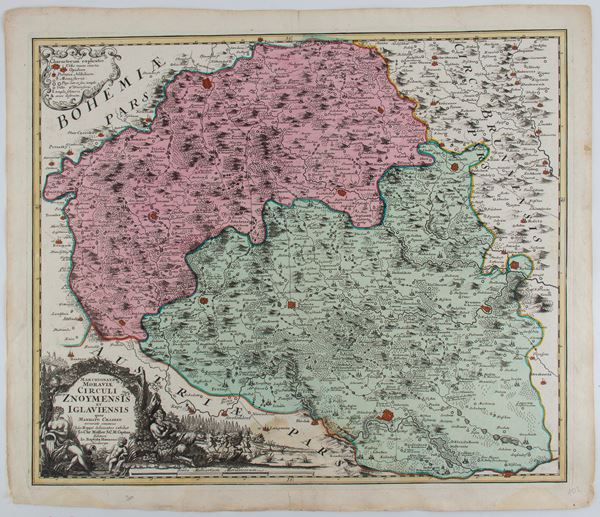
481
Johann Baptist Homann
(1664 - 1724)
Marchionatus Moraviae circuli Znoymensis et Iglaviensis
Nuremberg, 1750
Etching and engraving, 543 x 637 mm. Map of Znaim, Moravian region, southern Czech Republic, by Johann Christoph [..]
481
Johann Baptist Homann
(1664 - 1724)
Marchionatus Moraviae circuli Znoymensis et Iglaviensis
Nuremberg, 1750
Etching and engraving, 543 x 637 mm. Map of Znaim, Moravian region, southern Czech Republic, by Johann Christoph [..]
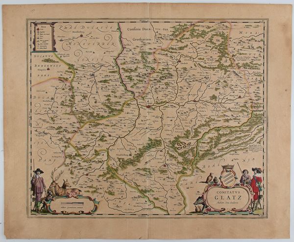
482
Comitatus Glatz. Authore Jona Sculteto
Etching and engraving, 490 x 600 mm. Map of the district of Glatz, a Prussian district in Silesia, which existed [..]
482
Comitatus Glatz. Authore Jona Sculteto
Etching and engraving, 490 x 600 mm. Map of the district of Glatz, a Prussian district in Silesia, which existed [..]
483
Willem Janszoon Blaeu
(1571 - 1638)
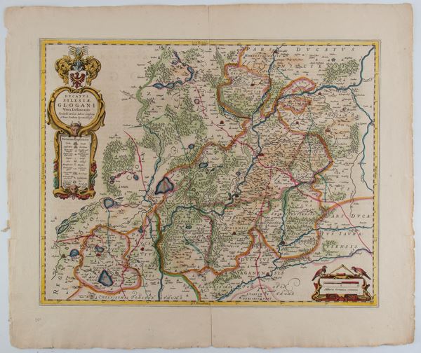
Ducatus Silesiae Glogani Vera Delineatio
Etching and engraving, 534 x 632 mm. Map of the municipality of Glogów, today in Lower Silesia in Poland, on [..]
483
Willem Janszoon Blaeu
(1571 - 1638)
Ducatus Silesiae Glogani Vera Delineatio
Etching and engraving, 534 x 632 mm. Map of the municipality of Glogów, today in Lower Silesia in Poland, on [..]
484
Willem Janszoon Blaeu
(1571 - 1638)
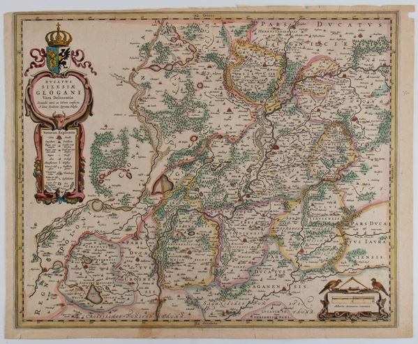
Ducatus Silesiae Glogani Vera Delineatio
Amsterdam, 1640
Etching and engraving, 430 x 535 mm. Map of the Duchy of Glogów, today in Silesia in Poland. Very nice colored [..]
484
Willem Janszoon Blaeu
(1571 - 1638)
Ducatus Silesiae Glogani Vera Delineatio
Amsterdam, 1640
Etching and engraving, 430 x 535 mm. Map of the Duchy of Glogów, today in Silesia in Poland. Very nice colored [..]
485
Johann Baptist Homann
(1664 - 1724)
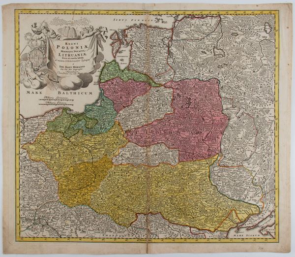
Regni Poloniae Magnique Ducatus Lithuaniae Nova et Exacta Tabula
Nuremberg, 1729
Etching and engraving, 520 x 600 mm. Map of Poland and the Grand Duchy of Lithuania, extending from the Baltic [..]
485
Johann Baptist Homann
(1664 - 1724)
Regni Poloniae Magnique Ducatus Lithuaniae Nova et Exacta Tabula
Nuremberg, 1729
Etching and engraving, 520 x 600 mm. Map of Poland and the Grand Duchy of Lithuania, extending from the Baltic [..]
486
Abraham Ortelius
(1527 - 1598)
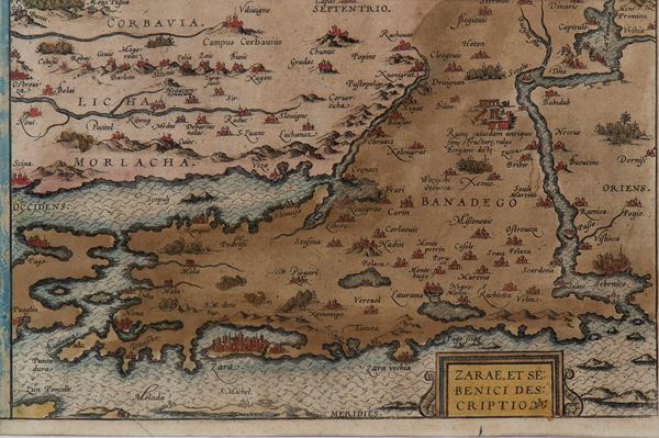
Zarae et Sebenici descriptio
Engraving, 150 x 240 mm (plate). Map of Croatia and Dalmatia taken from "Theatrum Orbis Terrarum". Fine, hand-colored [..]
486
Abraham Ortelius
(1527 - 1598)
Zarae et Sebenici descriptio
Engraving, 150 x 240 mm (plate). Map of Croatia and Dalmatia taken from "Theatrum Orbis Terrarum". Fine, hand-colored [..]
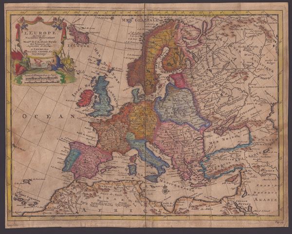
487
Pieter van der Aa
(1659 - 1733)
L'Europe Suivant les Nouvelles Observations...
1746
Etching and engraving, 242 x 305 mm (sheet). Map of Europe printed on laid paper with double watermark, trimmed [..]
487
Pieter van der Aa
(1659 - 1733)
L'Europe Suivant les Nouvelles Observations...
1746
Etching and engraving, 242 x 305 mm (sheet). Map of Europe printed on laid paper with double watermark, trimmed [..]
![Guillaume de l'Isle (1675-1726) - Carte d'Europe dressée pour l'usage du Roy [sic] sur les itinéraires anciens et modernes et sur les routiers de mer assujettis aux observations astronomiques](https://api.bertolamifineart.com/api/lotto/immagine/117991/0/600.jpg)
488
Guillaume de l'Isle (1675-1726)
Carte d'Europe dressée pour l'usage du Roy [sic] sur les itinéraires anciens et modernes et sur les routiers de mer assujettis aux observations astronomiques
1782
Etching and engraving, 500 x 625 mm (plate), 530 x 725 mm (sheet). Map of Europe printed on laid paper with [..]
488
Guillaume de l'Isle (1675-1726)
Carte d'Europe dressée pour l'usage du Roy [sic] sur les itinéraires anciens et modernes et sur les [..]
1782
Etching and engraving, 500 x 625 mm (plate), 530 x 725 mm (sheet). Map of Europe printed on laid paper with [..]
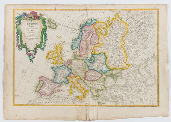
489
Jean Robert Janvier
(1776)
L'Europe divisée en ses principaux Etats
1782
Etching and engraving, 360 x 508 mm. Map of Europe printed on laid paper without watermark, with preserved margins [..]
489
Jean Robert Janvier
(1776)
L'Europe divisée en ses principaux Etats
1782
Etching and engraving, 360 x 508 mm. Map of Europe printed on laid paper without watermark, with preserved margins [..]
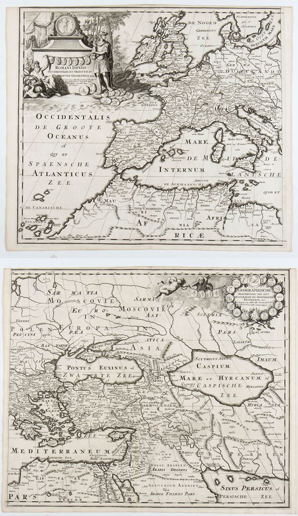
490
François Halma
(1653 - 1722)
Romani Imperii Occidentalis et Orientalis Decriptio Geographica Auct
1700 approx.
Printed on two sheets yet to be joined. Engraving and etching, 390 x 452 mm (each sheet). Map of the Roman Empire, [..]
490
François Halma
(1653 - 1722)
Romani Imperii Occidentalis et Orientalis Decriptio Geographica Auct
1700 approx.
Printed on two sheets yet to be joined. Engraving and etching, 390 x 452 mm (each sheet). Map of the Roman Empire, [..]
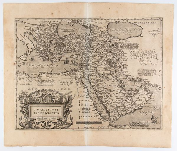
491
Abraham Ortelius
(1527 - 1598)
Turcici Imperii Descriptio
Engraving and etching, 482 x 563 mm (sheet). Map of the Middle East from the Latin edition of Ortelius' Theatrum [..]
491
Abraham Ortelius
(1527 - 1598)
Turcici Imperii Descriptio
Engraving and etching, 482 x 563 mm (sheet). Map of the Middle East from the Latin edition of Ortelius' Theatrum [..]
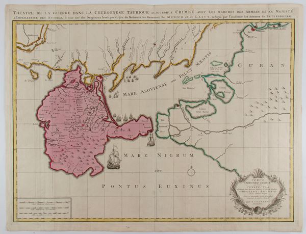
492
Reinier Ottens
(1698 - 1750)
Versus Chersonesi Tauricae Seu Crimeae Conspectus...
Amsterdam, 1737
Etching and engraving, 536 x 700 mm. Map of Crimea with surrounding areas during the Turkish-Austrian War (1736-1739). [..]
492
Reinier Ottens
(1698 - 1750)
Versus Chersonesi Tauricae Seu Crimeae Conspectus...
Amsterdam, 1737
Etching and engraving, 536 x 700 mm. Map of Crimea with surrounding areas during the Turkish-Austrian War (1736-1739). [..]
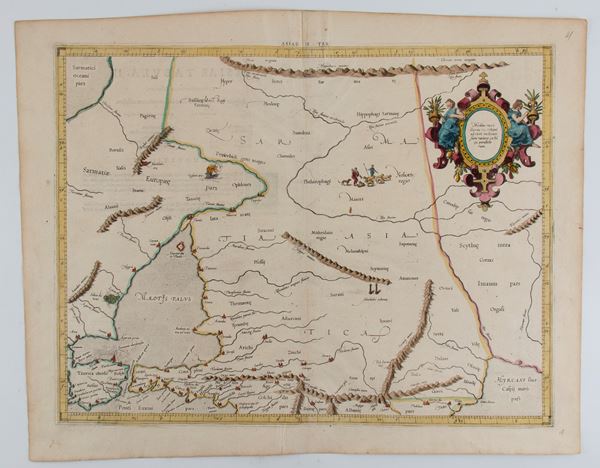
493
Gerardus Mercator
(1512 - 1594)
ASIAE TAB II
Etching and engraving, 410 x 535 mm (sheet). Map of the territories of present-day Armenia, Georgia, eastern Turkey [..]
493
Gerardus Mercator
(1512 - 1594)
ASIAE TAB II
Etching and engraving, 410 x 535 mm (sheet). Map of the territories of present-day Armenia, Georgia, eastern Turkey [..]
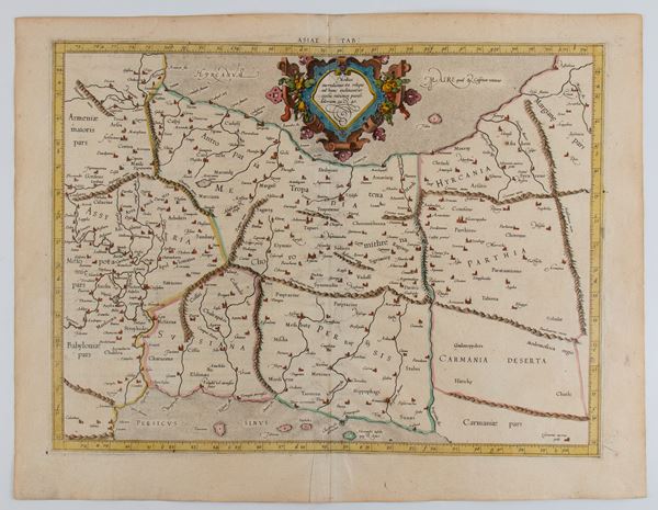
494
Gerardus Mercator
(1512 - 1594)
ASIAE V TAB
Etching and engraving, 410 x 535 mm (sheet). Map of the present territories of Iran and Iraq. Fine impression [..]
494
Gerardus Mercator
(1512 - 1594)
ASIAE V TAB
Etching and engraving, 410 x 535 mm (sheet). Map of the present territories of Iran and Iraq. Fine impression [..]
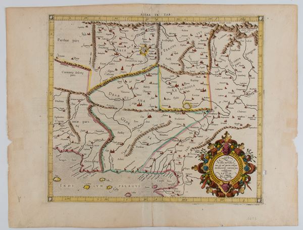
495
Gerardus Mercator
(1512 - 1594)
ASIAE IX TAB
1584
Etching and engraving, 410 x 535 mm (sheet). Beautiful map of the present territories of Pakistan, Afghanistan [..]
495
Gerardus Mercator
(1512 - 1594)
ASIAE IX TAB
1584
Etching and engraving, 410 x 535 mm (sheet). Beautiful map of the present territories of Pakistan, Afghanistan [..]
496
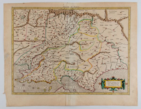
Gerardus Mercator
(1512 - 1594)
ASIAE X TAB
Etching and engraving, 410 x 535 mm (sheet). Map of the present territory of India. Fine impression with [..]
496
Gerardus Mercator
(1512 - 1594)
ASIAE X TAB
Etching and engraving, 410 x 535 mm (sheet). Map of the present territory of India. Fine impression with [..]
497
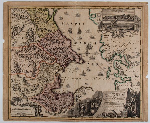
Johann Baptist Homann
(1664 - 1724)
Provinciarum Persicarum Kilaniae nempe Chirvaniae Dagestaniae
Etching and engraving, 517 x 627 mm (sheet). Map showing parts of present-day Georgia, Armenia, Dagestan, Azerbaijan [..]
497
Johann Baptist Homann
(1664 - 1724)
Provinciarum Persicarum Kilaniae nempe Chirvaniae Dagestaniae
Etching and engraving, 517 x 627 mm (sheet). Map showing parts of present-day Georgia, Armenia, Dagestan, Azerbaijan [..]
498
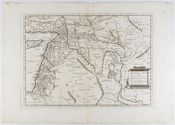
Philippe de La Rue
Assyria vetus divisa in Syriam, Messopotamiam, Babyloniam, et Assyriam
1695
Etching and engraving, 500 x 700 mm. Later edition of the train map of historical Assyria (now Israel, Lebanon, [..]
498
Philippe de La Rue
Assyria vetus divisa in Syriam, Messopotamiam, Babyloniam, et Assyriam
1695
Etching and engraving, 500 x 700 mm. Later edition of the train map of historical Assyria (now Israel, Lebanon, [..]
499
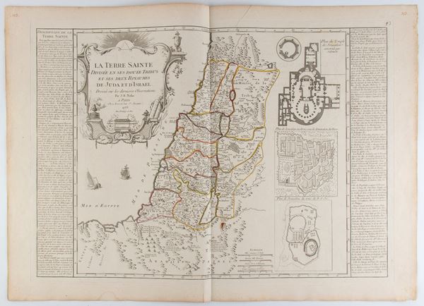
Jean-Baptiste Nolin
(1657 - 1725)
La Terre Sainte divisée en ses douze tribus et ses deux royaumes de Juda et d'Israël
1785
Etching and engraving, 553 x 768 mm. Historical map of the Holy Land, corresponding to the current territories [..]
499
Jean-Baptiste Nolin
(1657 - 1725)
La Terre Sainte divisée en ses douze tribus et ses deux royaumes de Juda et d'Israël
1785
Etching and engraving, 553 x 768 mm. Historical map of the Holy Land, corresponding to the current territories [..]
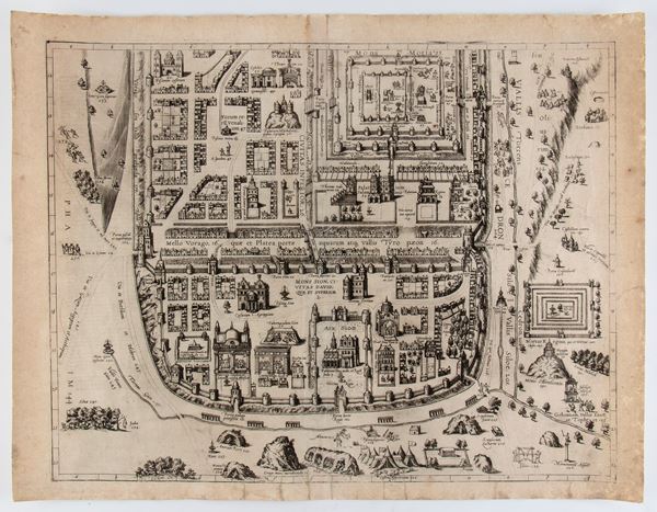
500
City of Jerusalem
Engraving and etching, 414 x 537 mm. Ancient plan of the City of Jerusalem. Copy printed on laid paper, with [..]
500
City of Jerusalem
Engraving and etching, 414 x 537 mm. Ancient plan of the City of Jerusalem. Copy printed on laid paper, with [..]
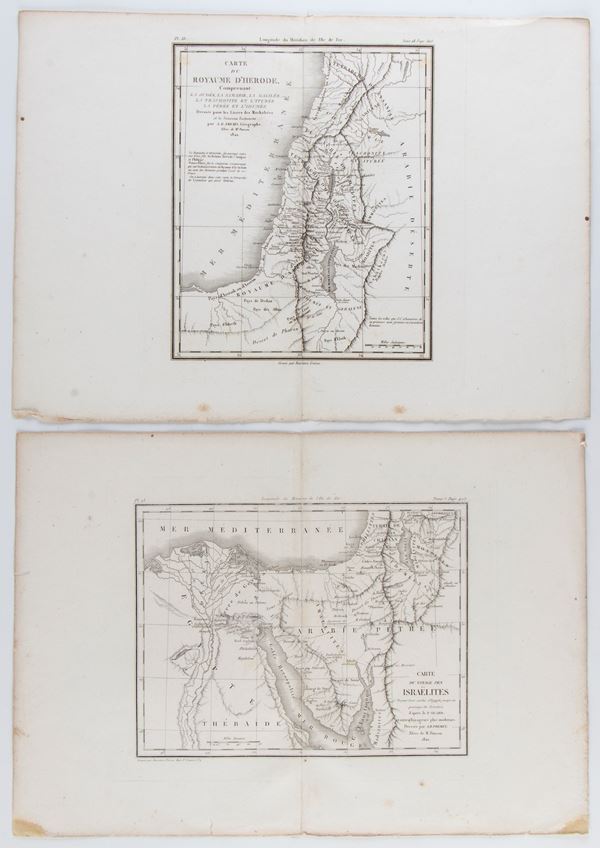
501
Antoine Rémy Frémin
Carte du voyage des Israelites | Carte du royaume d'Hérode
1820-1822
Etching and engraving, 283 x 400 mm (each sheet). Lot of two maps corresponding to the current territories of [..]
501
Antoine Rémy Frémin
Carte du voyage des Israelites | Carte du royaume d'Hérode
1820-1822
Etching and engraving, 283 x 400 mm (each sheet). Lot of two maps corresponding to the current territories of [..]
502
Henri Abraham Chatelain
(1684 - 1743)
Chaine de L'Histoire Sacree | Carte pour conduire à l'intelligence de l'histoire sacrée... | Carte Historique ... la vocation de St. Paul | Epoques Anciennes depuis le Deluge jusqu'a la Vocation d'Abraham
Lot of four prints: Chaine de L'Histoire Sacree: Chain De L'Histoire Prophane Cards to lead to the intelligence [..]
502
Henri Abraham Chatelain
(1684 - 1743)
Chaine de L'Histoire Sacree | Carte pour conduire à l'intelligence de l'histoire sacrée... | Carte Historique [..]
Lot of four prints: Chaine de L'Histoire Sacree: Chain De L'Histoire Prophane Cards to lead to the intelligence [..]
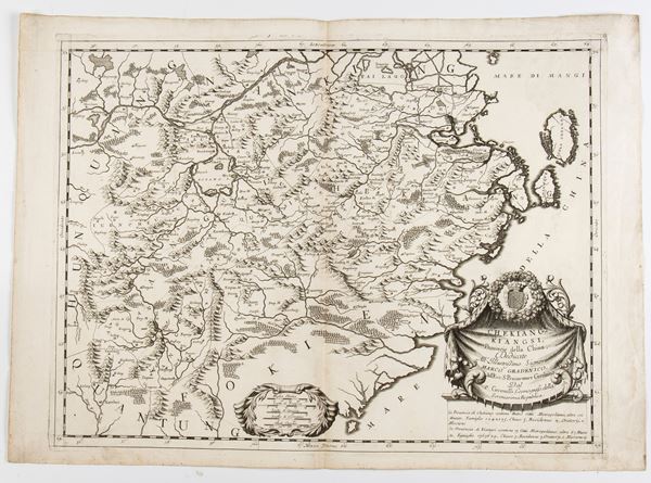
503
Vincenzo Maria Coronelli
(1650 - 1718)
Chekiang, and Kiangsi, Provinces of China...
Engraving and etching, 495 x 700 mm. Map of China with the provinces of Zhejiang and Jiangxi A fine example [..]
503
Vincenzo Maria Coronelli
(1650 - 1718)
Chekiang, and Kiangsi, Provinces of China...
Engraving and etching, 495 x 700 mm. Map of China with the provinces of Zhejiang and Jiangxi A fine example [..]
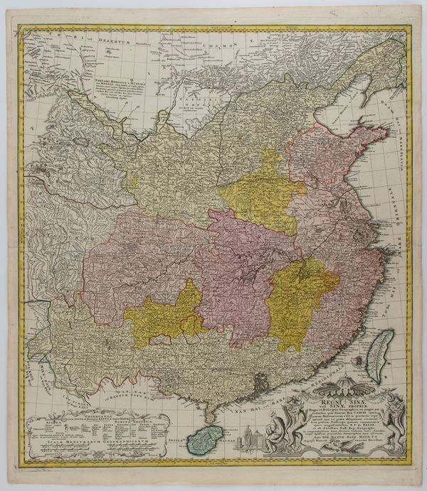
504
Eredi Johann Baptist Homann
Regni Sinae vel Sinae Propriae Mappa et Descriptio
Etching and engraving, 627 x 550 mm. Detailed map of China, showing the territory from the Gobi Desert to the [..]
504
Eredi Johann Baptist Homann
Regni Sinae vel Sinae Propriae Mappa et Descriptio
Etching and engraving, 627 x 550 mm. Detailed map of China, showing the territory from the Gobi Desert to the [..]
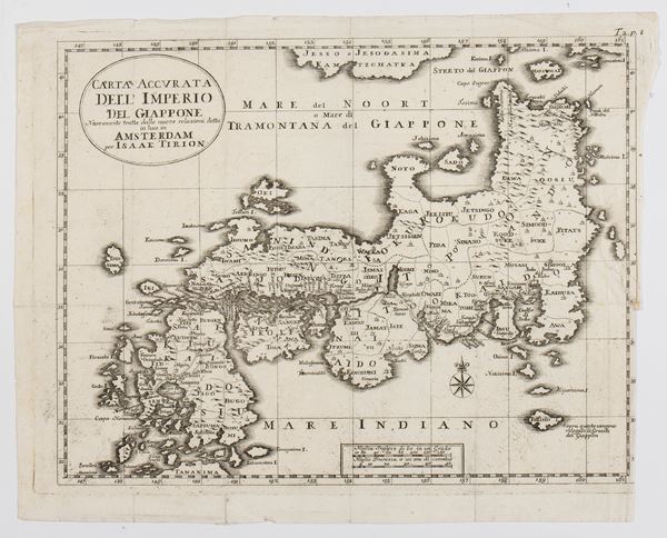
505
Isaak Tirion
(Utrecht, 1705 - Amsterdam, 1765)
Carta Accurata dell' Imperio del Giappone
Engraving and etching, 280 x 350 mm. Very nice impression on thin laid paper with watermark. In very good condition, [..]
505
Isaak Tirion
(Utrecht, 1705 - Amsterdam, 1765)
Carta Accurata dell' Imperio del Giappone
Engraving and etching, 280 x 350 mm. Very nice impression on thin laid paper with watermark. In very good condition, [..]
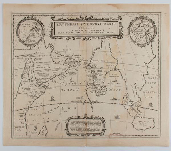
506
Johannes Janssonius
(1588 - 1664)
Erythraei Sive Rubri Maris Periplus
Amsterdam, 1658
Etching and engraving, 448 x 523 mm. Map of the Indian Ocean, known in antiquity as the Erythraean Sea. Nice [..]
506
Johannes Janssonius
(1588 - 1664)
Erythraei Sive Rubri Maris Periplus
Amsterdam, 1658
Etching and engraving, 448 x 523 mm. Map of the Indian Ocean, known in antiquity as the Erythraean Sea. Nice [..]
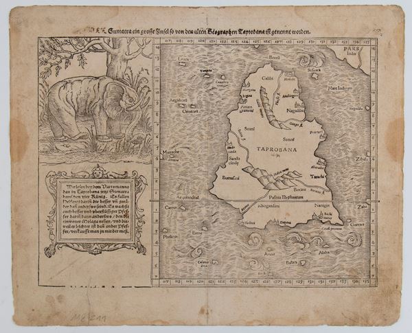
507
Sebastian Münster
(Ingelheim, 1488 - Basilea, 1552)
Taprobana Island (Sri Lanka)
1574
Woodcut, 322 x 392 mm (sheet). Map of Taprobana, the name by which the ancient Greeks identified the island of [..]
507
Sebastian Münster
(Ingelheim, 1488 - Basilea, 1552)
Taprobana Island (Sri Lanka)
1574
Woodcut, 322 x 392 mm (sheet). Map of Taprobana, the name by which the ancient Greeks identified the island of [..]
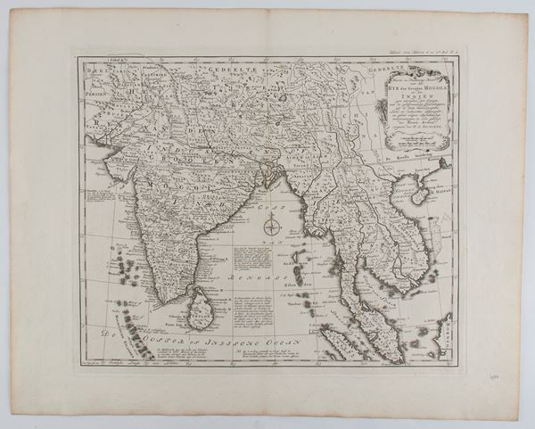
508
Nieuwe en Naukeurige Kaart van Het Ryk des Grooten Mogols en der Indien
Amsterdam, 1785
Engraving and etching, 447 x 563 mm. Dutch edition of the map of India and the Maldives. Fine impression [..]
508
Nieuwe en Naukeurige Kaart van Het Ryk des Grooten Mogols en der Indien
Amsterdam, 1785
Engraving and etching, 447 x 563 mm. Dutch edition of the map of India and the Maldives. Fine impression [..]
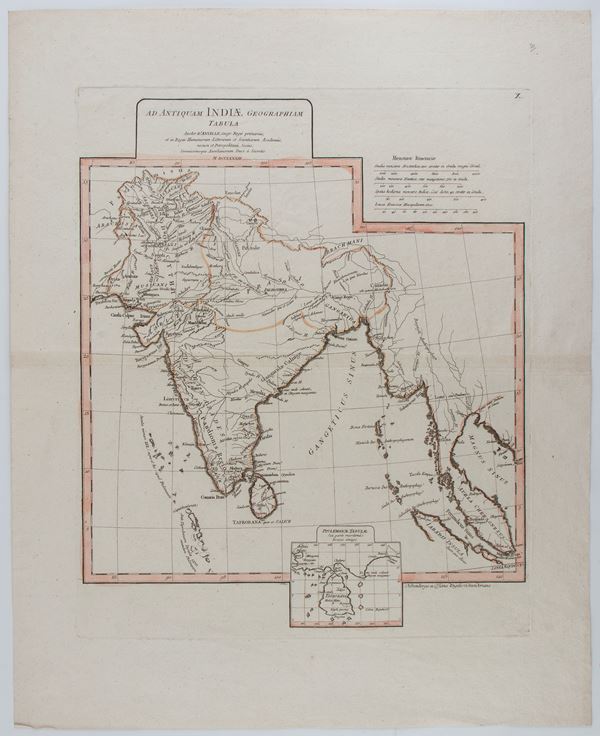
509
Jean-Baptiste d'Anville
(1697 - 1782)
Ad Antiquam Indiae Geographiam Tabula
Paris, 1765
Etching and engraving, 608 x 490 mm. Map of India, printed on laid paper with watermark and hand-colored. With [..]
509
Jean-Baptiste d'Anville
(1697 - 1782)
Ad Antiquam Indiae Geographiam Tabula
Paris, 1765
Etching and engraving, 608 x 490 mm. Map of India, printed on laid paper with watermark and hand-colored. With [..]