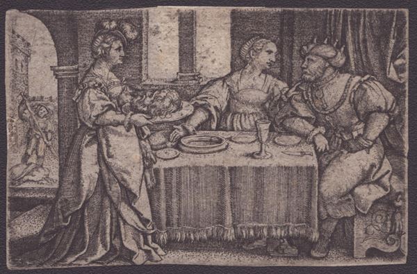
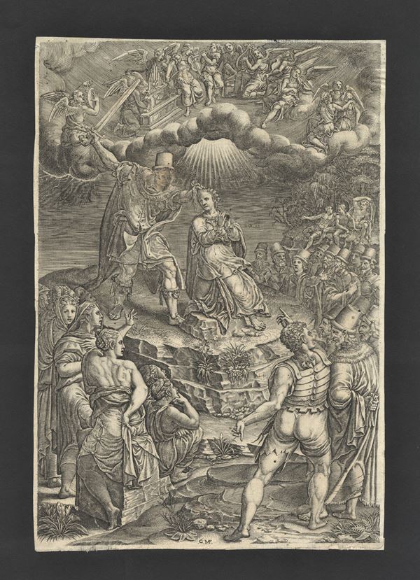
81
Georg Pencz
(1550)
Salome with the Head of Saint John the Baptist
c.1533
Engraving, 49 x 71 mm. Bartsch VIII.29. Fine, sharp and fresh impression on thin laid paper. Trimmed. In very [..]
81
Georg Pencz
(1550)
Salome with the Head of Saint John the Baptist
c.1533
Engraving, 49 x 71 mm. Bartsch VIII.29. Fine, sharp and fresh impression on thin laid paper. Trimmed. In very [..]
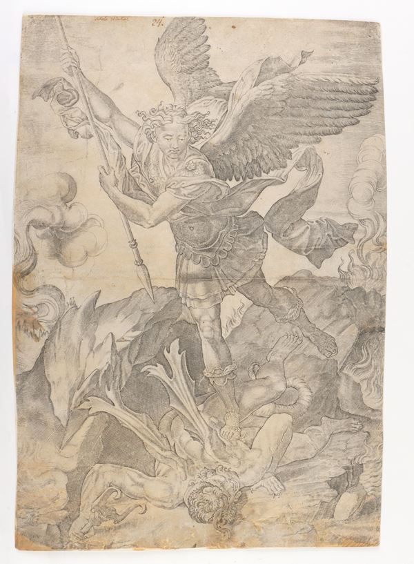
82
Nicolas Beatrizet
(1573)
Saint Michael defeats Satan
after Raphael. Engraving, 428 x 297 mm. Bernini Pezzini et al., Raphael Invenit, 1985, n.VI Sharp impression [..]
82
Nicolas Beatrizet
(1573)
Saint Michael defeats Satan
after Raphael. Engraving, 428 x 297 mm. Bernini Pezzini et al., Raphael Invenit, 1985, n.VI Sharp impression [..]
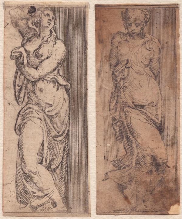
83
Angelo Falconetto
(1507 - 1567)
Caryatid | Young woman
Lot of two etchings, 111 x 44 mm each. Bartsch XX.8 and 9. The first is a fine impression on laid paper with [..]
83
Angelo Falconetto
(1507 - 1567)
Caryatid | Young woman
Lot of two etchings, 111 x 44 mm each. Bartsch XX.8 and 9. The first is a fine impression on laid paper with [..]
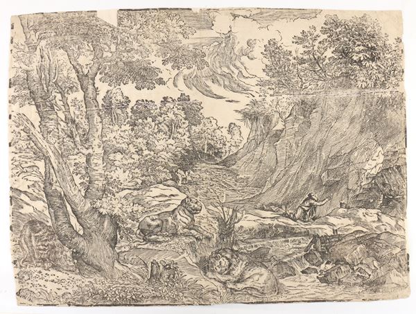
84
Nicolò Boldrini
(1510 - 1570)
Saint Jerome in the desert
by Titian. Woodcut, 395 x 532 mm. Passavant VI.58, Rosand & Muraro, Titian and the Venetian Woodcut, 1976, [..]
84
Nicolò Boldrini
(1510 - 1570)
Saint Jerome in the desert
by Titian. Woodcut, 395 x 532 mm. Passavant VI.58, Rosand & Muraro, Titian and the Venetian Woodcut, 1976, [..]
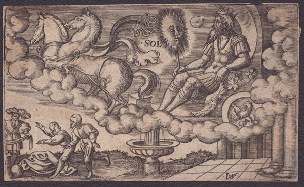
85
Virgil Solis
(1514 - 1562)
The Sun
from the Seven Planets series. Engraving, 51 x 85 mm. Bartsch IX.166. Fine, sharp impression on laid [..]
85
Virgil Solis
(1514 - 1562)
The Sun
from the Seven Planets series. Engraving, 51 x 85 mm. Bartsch IX.166. Fine, sharp impression on laid [..]
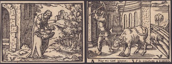
86
Virgil Solis
(1514 - 1562)
Woman butchering a rooster | Man butchering a bully
Woodcut, 51 x 69 mm (sheet). Printed on both sides of the same sheet of laid paper, in excellent condition.
86
Virgil Solis
(1514 - 1562)
Woman butchering a rooster | Man butchering a bully
Woodcut, 51 x 69 mm (sheet). Printed on both sides of the same sheet of laid paper, in excellent condition.
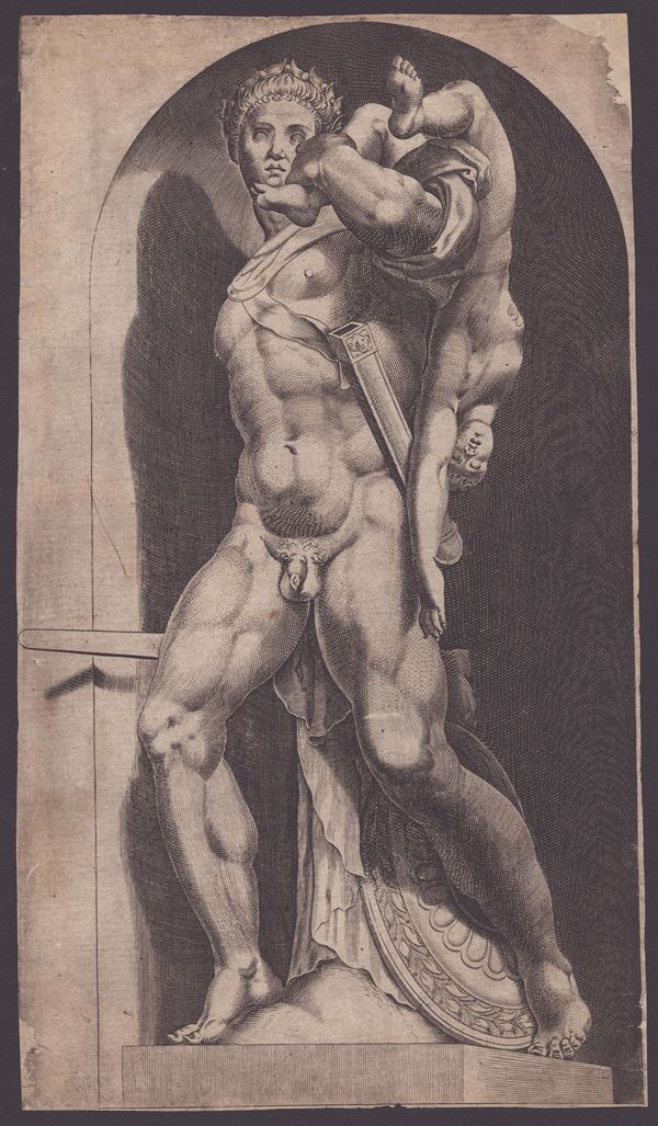
87
Cornelis Cort
(Hoorn, 1533 - Roma, 1578)
Atreus Farnese from "Speculum Romanae Magnificentiae"
1574
Engraving, 344 x 196 mm. Splendid proof on thin laid paper. Trimmed, with upper right corner missing. Another [..]
87
Cornelis Cort
(Hoorn, 1533 - Roma, 1578)
Atreus Farnese from "Speculum Romanae Magnificentiae"
1574
Engraving, 344 x 196 mm. Splendid proof on thin laid paper. Trimmed, with upper right corner missing. Another [..]
88
Giorgio Ghisi
(Mantova, 1520 - 1582)
The Martyrdom of Saint Barbara
Engraving, 270 x 187 mm. II state of 2, with the artist's monogram in the center. Lewis 63, Bartsch XV.10, Massari [..]
88
Giorgio Ghisi
(Mantova, 1520 - 1582)
The Martyrdom of Saint Barbara
Engraving, 270 x 187 mm. II state of 2, with the artist's monogram in the center. Lewis 63, Bartsch XV.10, Massari [..]
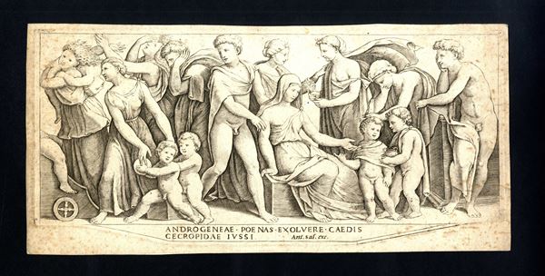
89
Maestro del Dado
(1530)
The Marriage of Jason and Creusa
Engraving, 326 x 157 mm. Bartsch XV.28. Later edition, printed on heavy laid paper. Trimmed to the platemark. [..]
89
Maestro del Dado
(1530)
The Marriage of Jason and Creusa
Engraving, 326 x 157 mm. Bartsch XV.28. Later edition, printed on heavy laid paper. Trimmed to the platemark. [..]
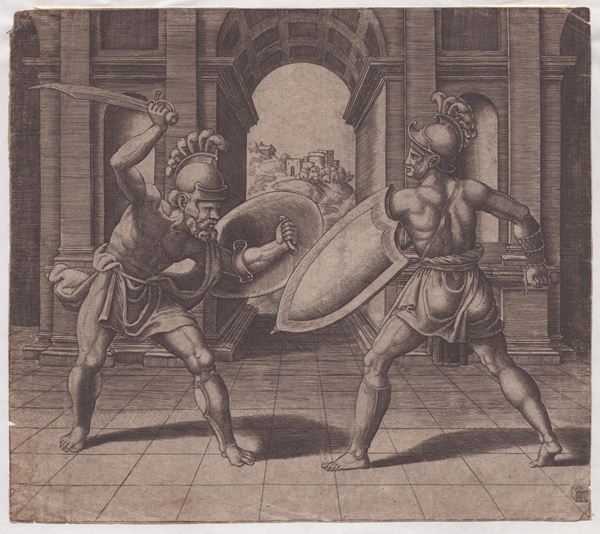
90
Maestro del Dado
(1530)
Two Gladiators fighting
Engraving, 206 x 233 mm. Bartsch XV.77 Sharp impression printed on laid paper. Trimmed. Paper uniformly oxidized. [..]
90
Maestro del Dado
(1530)
Two Gladiators fighting
Engraving, 206 x 233 mm. Bartsch XV.77 Sharp impression printed on laid paper. Trimmed. Paper uniformly oxidized. [..]
91
Maestro del Dado
(1530)
Cupid Fleeing from Psyche
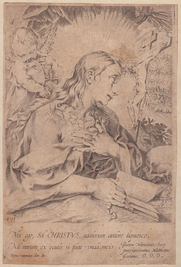
from the Cupid and Psyche series after Michiel Coxie I. Engraving, 198 x 238 mm (plate), 240 x 296 mm (sheet). [..]
91
Maestro del Dado
(1530)
Cupid Fleeing from Psyche
from the Cupid and Psyche series after Michiel Coxie I. Engraving, 198 x 238 mm (plate), 240 x 296 mm (sheet). [..]
92
Maestro del Dado
(1530)
Venus and Psyche
from the series with the story of Cupid and Psyche by Michiel Coxie I. Burin, 200 x 233 mm (plate), 239 x 296 [..]
92
Maestro del Dado
(1530)
Venus and Psyche
from the series with the story of Cupid and Psyche by Michiel Coxie I. Burin, 200 x 233 mm (plate), 239 x 296 [..]
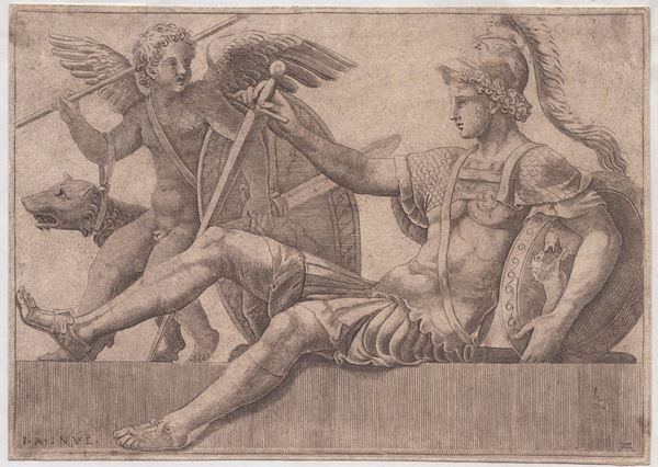
93
Adamo Scultori
(Mantova, 1530 - 1585)
Mars
by Gulio Romano. Burin, 142 x 202 mm. Bartsch XV.25, Bellini 19. Clear impression on laid paper. Exemplary [..]
93
Adamo Scultori
(Mantova, 1530 - 1585)
Mars
by Gulio Romano. Burin, 142 x 202 mm. Bartsch XV.25, Bellini 19. Clear impression on laid paper. Exemplary [..]
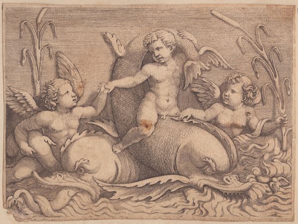
94
Adamo Scultori
(Mantova, 1530 - 1585)
Three putti with sea monsters
Engraving, 119 x 162 mm. Bartsch XV.23, Bellini 105 Printed on laid paper, exemplary with small margins. In [..]
94
Adamo Scultori
(Mantova, 1530 - 1585)
Three putti with sea monsters
Engraving, 119 x 162 mm. Bartsch XV.23, Bellini 105 Printed on laid paper, exemplary with small margins. In [..]
95
Adamo Scultori
(Mantova, 1530 - 1585)
Hercules at the crossroads
after Giulio Romano. Engraving, 197 x 284 mm (plate), 247 x 370 mm (sheet). Single state. Bartsch XV.26, [..]
95
Adamo Scultori
(Mantova, 1530 - 1585)
Hercules at the crossroads
after Giulio Romano. Engraving, 197 x 284 mm (plate), 247 x 370 mm (sheet). Single state. Bartsch XV.26, [..]
96
Giovanni Battista Cavalieri
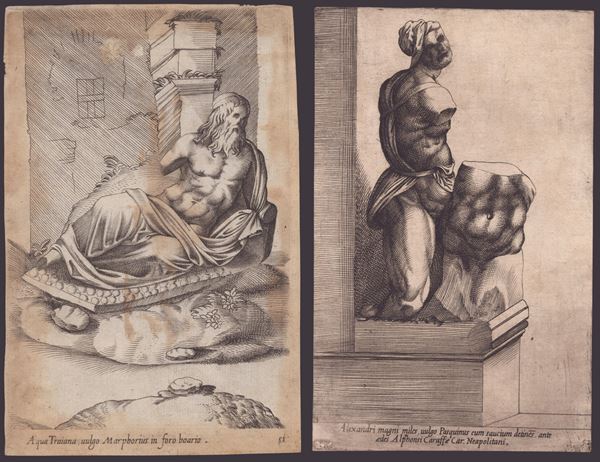
(1601)
Alexandri magni miles, vuoto Pasquinus... | Acqua Traiana, vulgo Marphorius in foro boario
Lot of two etchings from "ANTIQUARUM STATUARUM URBIS ROMAE". 201 x 126 mm and 204 x 133 mm. Printed on laid paper. [..]
96
Giovanni Battista Cavalieri
(1601)
Alexandri magni miles, vuoto Pasquinus... | Acqua Traiana, vulgo Marphorius in foro boario
Lot of two etchings from "ANTIQUARUM STATUARUM URBIS ROMAE". 201 x 126 mm and 204 x 133 mm. Printed on laid paper. [..]
97
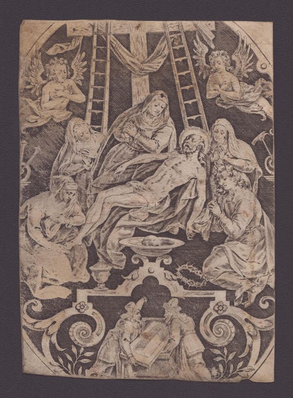
Jan (Johannes) Sadeler
(Bruxelles, 1550 - Bruxelles o Venezia, 1600)
Marcus Gheeraerts I
Lamentation over the dead Christ
Engraving, 122 x 87 mm. Hollstein 87. Printed on parchment. Missing 1-2 cm from each side.
97
Jan (Johannes) Sadeler
(Bruxelles, 1550 - Bruxelles o Venezia, 1600)
Marcus Gheeraerts I
Lamentation over the dead Christ
Engraving, 122 x 87 mm. Hollstein 87. Printed on parchment. Missing 1-2 cm from each side.
98
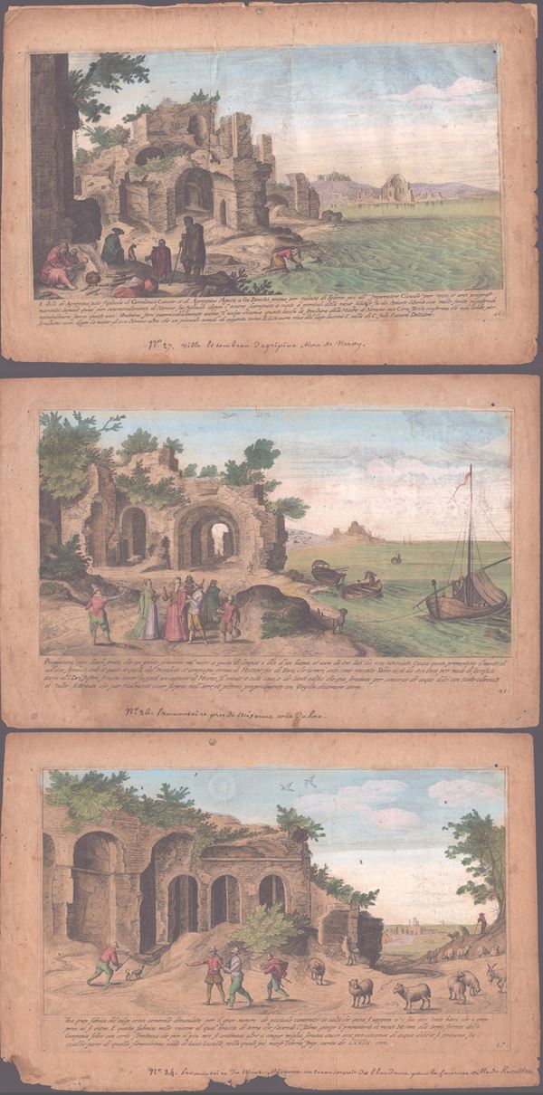
Aegidius Sadeler II
(Anversa, 1568 - Praga, 1629)
Vestigi delle antichita di Roma Tivoli Pozzuolo et altri luochi...
Lot of three plates (45-47) from the work "Vestigi delle antichita di Roma Tivoli Pozzuolo et altri luochi..." [..]
98
Aegidius Sadeler II
(Anversa, 1568 - Praga, 1629)
Vestigi delle antichita di Roma Tivoli Pozzuolo et altri luochi...
Lot of three plates (45-47) from the work "Vestigi delle antichita di Roma Tivoli Pozzuolo et altri luochi..." [..]
99
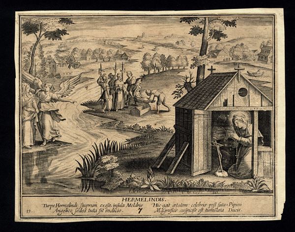
Adriaen Collaert
(1560 - 1618)
Based on
Hermelindis
copy in reverse of Adriaen Collaert's engraving after Marten De Vos. Engraving, 182 x 146 mm. Trimmed to the [..]
99
Adriaen Collaert
(1560 - 1618)
Based on
Hermelindis
copy in reverse of Adriaen Collaert's engraving after Marten De Vos. Engraving, 182 x 146 mm. Trimmed to the [..]
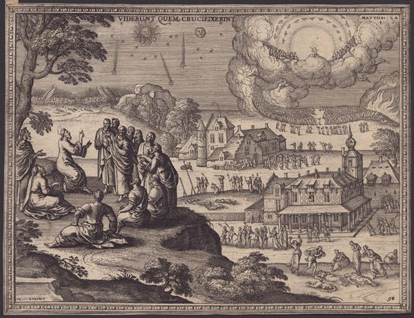
100
Pieter van der Borcht
(1608)
Mount of Olives (Matthew 24)
Taken from "Imagines et Figurae Bibliorum". Etching, 186 x 244 mm. III state. New Hollstein 325. Hubert Dupond's [..]
100
Pieter van der Borcht
(1608)
Mount of Olives (Matthew 24)
Taken from "Imagines et Figurae Bibliorum". Etching, 186 x 244 mm. III state. New Hollstein 325. Hubert Dupond's [..]
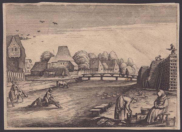
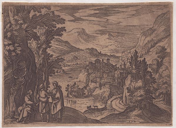
101
Landscape with houses and figures
anonymous 17th century Flemish engraver
Etching, 120 x 165 mm. Fine and fresh impression, backed on another sheet of paper.
101
Landscape with houses and figures
anonymous 17th century Flemish engraver
Etching, 120 x 165 mm. Fine and fresh impression, backed on another sheet of paper.
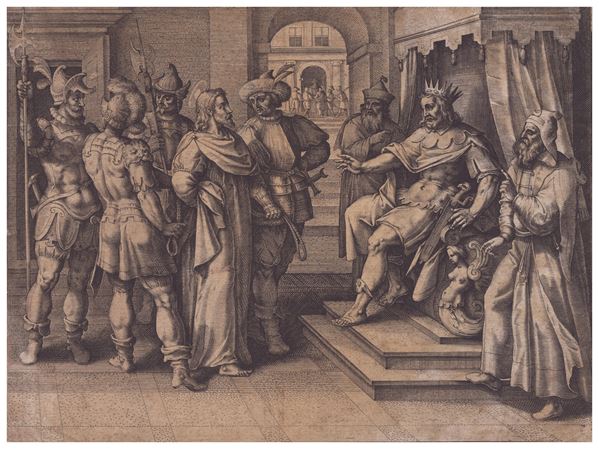
102
Jacques de Bie
(1581 - 1640)
Christ before Herod
after Maarten de Vos. From the series "Vita, Passio, et Resurrectio Iesu Christi". Engraving, 165 x 220 mm. Hollstein, [..]
102
Jacques de Bie
(1581 - 1640)
Christ before Herod
after Maarten de Vos. From the series "Vita, Passio, et Resurrectio Iesu Christi". Engraving, 165 x 220 mm. Hollstein, [..]
103
Theodoor Galle
(1571 - 1633)
Attributed to
Aegidius Sadeler II
(Anversa, 1568 - Praga, 1629)
Based on
The Flagellation of Christ
Engraving, 255 x 181 mm. Mirror copy of an engraving bay Aegidius Sadeler after Palma di Giovane's painting [..]
103
Theodoor Galle
(1571 - 1633)
Attributed to
Aegidius Sadeler II
(Anversa, 1568 - Praga, 1629)
Based on
The Flagellation of Christ
Engraving, 255 x 181 mm. Mirror copy of an engraving bay Aegidius Sadeler after Palma di Giovane's painting [..]
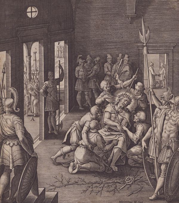
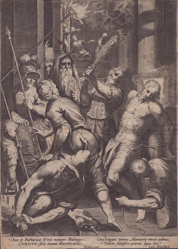
104
Hieronymus Wierix
(1553 - 1619)
Christ mocked
engraving, 165 x 140 mm. From the series of 153 plates 'Evangelicae Historiae Imagines'. Mauquoy-Hendrickx 2090. [..]
104
Hieronymus Wierix
(1553 - 1619)
Christ mocked
engraving, 165 x 140 mm. From the series of 153 plates 'Evangelicae Historiae Imagines'. Mauquoy-Hendrickx 2090. [..]
105
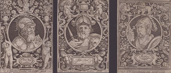
Nicolas de Bruyn
(1571 - 1656)
Josue Dux | Judas Machabeus| Artus Rex
1594
lot of 3 engravings from the series of 12 depicting the heads of the rulers in ornamental borders. Engraving, [..]
105
Nicolas de Bruyn
(1571 - 1656)
Josue Dux | Judas Machabeus| Artus Rex
1594
lot of 3 engravings from the series of 12 depicting the heads of the rulers in ornamental borders. Engraving, [..]
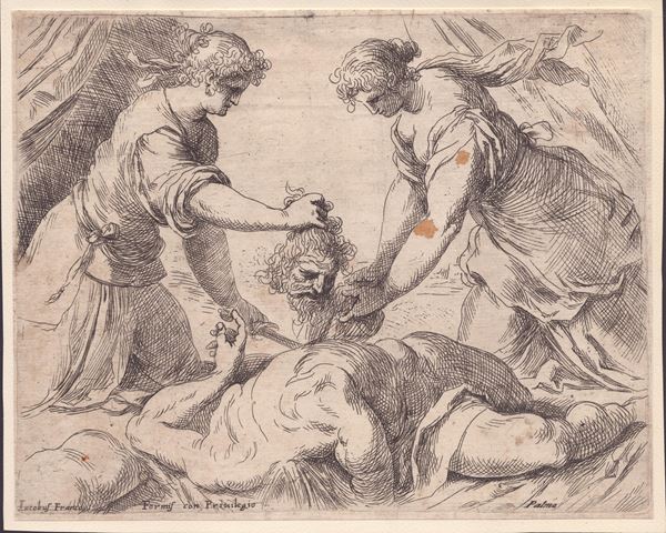
106
Jacopo Negretti detto Palma il Giovane
(Venezia, 1544 - 1628)
Judith and Holofernes
Etching, 180 x 225 mm. Bartsch XVI.25 Fine, fresh impression on thin laid paper. Specimen with narrow margins [..]
106
Jacopo Negretti detto Palma il Giovane
(Venezia, 1544 - 1628)
Judith and Holofernes
Etching, 180 x 225 mm. Bartsch XVI.25 Fine, fresh impression on thin laid paper. Specimen with narrow margins [..]
107
Pieter Maes
(1560)
Madonna and Child
Etching, 167 x 205 mm. Fine, fresh impression on laid paper. Proof with very narrow margins. Lower right and [..]
107
Pieter Maes
(1560)
Madonna and Child
Etching, 167 x 205 mm. Fine, fresh impression on laid paper. Proof with very narrow margins. Lower right and [..]
108
Francesco Villamena
(1566 - 1626)
Penitent Magdalene
after Francesco Vanni, published by Matteo Florimi. Etching, 225 x 150 mm. M. Bury, The Print in [..]
108
Francesco Villamena
(1566 - 1626)
Penitent Magdalene
after Francesco Vanni, published by Matteo Florimi. Etching, 225 x 150 mm. M. Bury, The Print in [..]
109
Antonio Tempesta
(1555 - 1630)
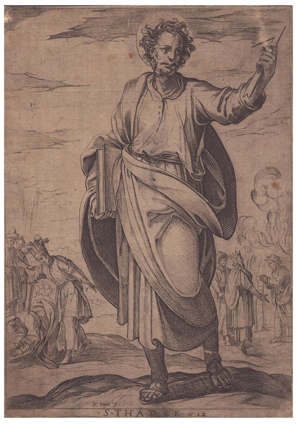
Judas Thaddeus
Etching, 201 x 142 mm. Fine impression on thin laid paper with a fragment of watermark. Trimmed. Generally [..]
109
Antonio Tempesta
(1555 - 1630)
Judas Thaddeus
Etching, 201 x 142 mm. Fine impression on thin laid paper with a fragment of watermark. Trimmed. Generally [..]
110
Antonio Tempesta
(1555 - 1630)
Landscape with figures
Etching, 129 x 179 mm. Bartsch 1172. Sharp impression on laid paper. With small margins and in very good [..]
110
Antonio Tempesta
(1555 - 1630)
Landscape with figures
Etching, 129 x 179 mm. Bartsch 1172. Sharp impression on laid paper. With small margins and in very good [..]
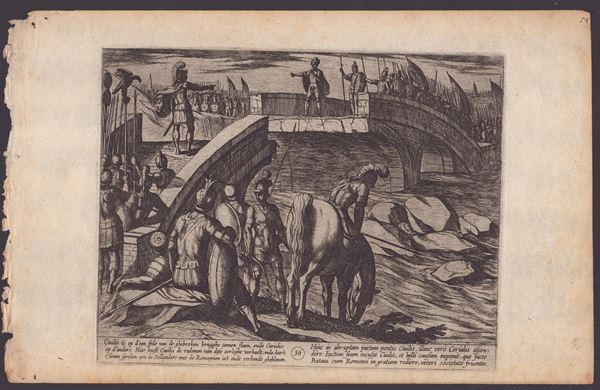
111
Antonio Tempesta
(1555 - 1630)
The meeting on the Broken Bridge from "The War of the Romans against the Batavians"
1611
after Otto van Veen. The last, 36th plate from the series "The war of the Romans against the Batavians". Etching, [..]
111
Antonio Tempesta
(1555 - 1630)
The meeting on the Broken Bridge from "The War of the Romans against the Batavians"
1611
after Otto van Veen. The last, 36th plate from the series "The war of the Romans against the Batavians". Etching, [..]
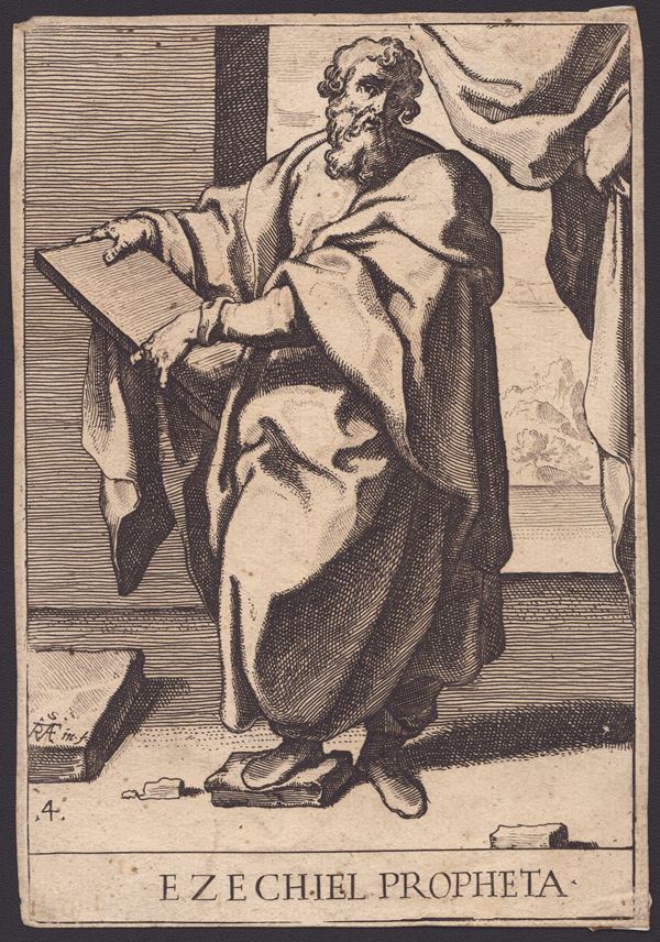
112
Raffaele Schiaminossi
(1572 - 1622)
Ezekiel
From the series of 12 prophets. Etching, 192 x 134 mm. Bartsch XVII.7. Fresh impression on laid paper. Trimmed. [..]
112
Raffaele Schiaminossi
(1572 - 1622)
Ezekiel
From the series of 12 prophets. Etching, 192 x 134 mm. Bartsch XVII.7. Fresh impression on laid paper. Trimmed. [..]
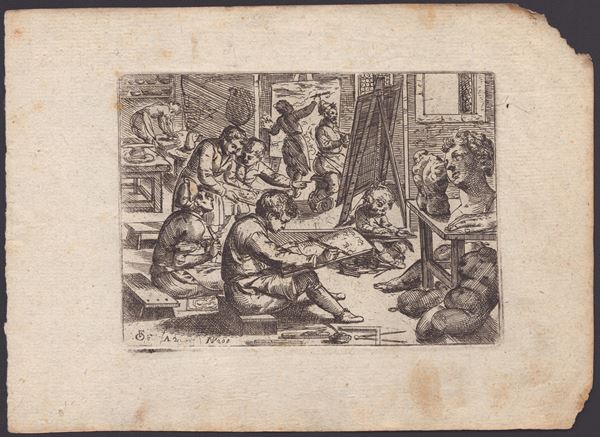
113
Odoardo Fialetti
(1573 - 1638)
School of drawing
1608
Etching, 112 x 155 mm (plate), 174 x 240 mm (sheet). Bartsch XVII.210. Beautiful, fresh impression on laid paper. [..]
113
Odoardo Fialetti
(1573 - 1638)
School of drawing
1608
Etching, 112 x 155 mm (plate), 174 x 240 mm (sheet). Bartsch XVII.210. Beautiful, fresh impression on laid paper. [..]
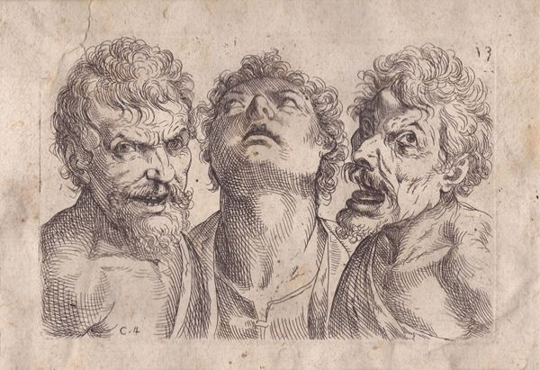
114
Odoardo Fialetti
(1573 - 1638)
Three male heads
from the series ""Il vero modo et ordine per dissegnar tutte le parte et membra del corpo humano" Etching, 105 [..]
114
Odoardo Fialetti
(1573 - 1638)
Three male heads
from the series ""Il vero modo et ordine per dissegnar tutte le parte et membra del corpo humano" Etching, 105 [..]
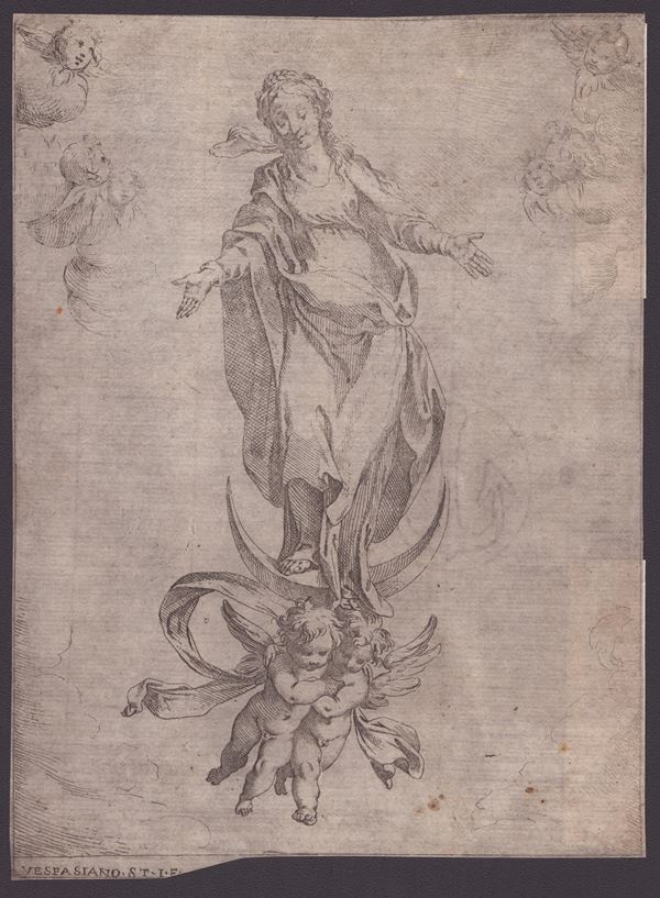
115
Vespasiano Strada
(1622)
Immaculate Conception
Etching, 192 x 140 mm. Bartsch XVII.10 Printed on very thin laid paper with watermark (anchor inside a circle). [..]
115
Vespasiano Strada
(1622)
Immaculate Conception
Etching, 192 x 140 mm. Bartsch XVII.10 Printed on very thin laid paper with watermark (anchor inside a circle). [..]
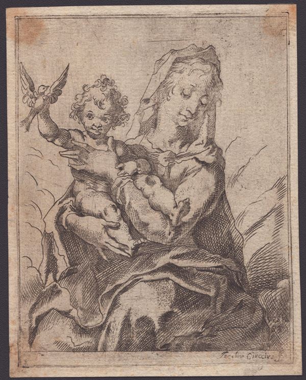
116
Jacopo Ciucci
Madonna with Child and a bird
copy in reverse after Vespasiano Strada. Etching, 128 x 100 mm (plate), 135 x 106 mm (sheet). Fine impression [..]
116
Jacopo Ciucci
Madonna with Child and a bird
copy in reverse after Vespasiano Strada. Etching, 128 x 100 mm (plate), 135 x 106 mm (sheet). Fine impression [..]
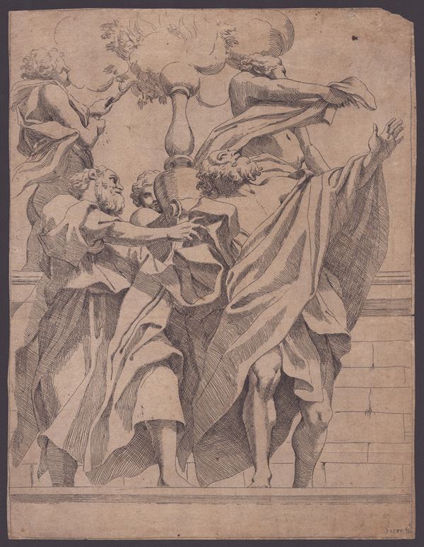
117
Sisto Badalocchio
(1585 - 1647)
Two prophets
from Correggio, from the series of 6 engravings from the frescoes of the Dome of the Cathedral of Parma. Etching, [..]
117
Sisto Badalocchio
(1585 - 1647)
Two prophets
from Correggio, from the series of 6 engravings from the frescoes of the Dome of the Cathedral of Parma. Etching, [..]
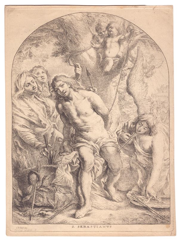
118
Cornelis Schut
(1597 - 1655)
Saint Sebastian
Etching, 306 x 225 mm (plate), 320 x 234 mm (sheet). Hollstein 105. Fine, sharp impression on laid [..]
118
Cornelis Schut
(1597 - 1655)
Saint Sebastian
Etching, 306 x 225 mm (plate), 320 x 234 mm (sheet). Hollstein 105. Fine, sharp impression on laid [..]
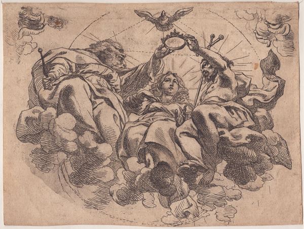
119
Cornelis Schut
(1597 - 1655)
Coronation of the Virgin
Etching, 151 x 206 mm. Hollstein 89. Fine and fresh impression on laid paper. Trimmed, in very good condition [..]
119
Cornelis Schut
(1597 - 1655)
Coronation of the Virgin
Etching, 151 x 206 mm. Hollstein 89. Fine and fresh impression on laid paper. Trimmed, in very good condition [..]
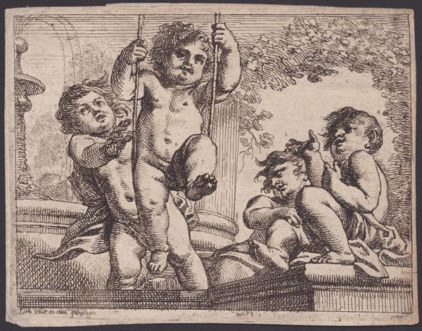
120
Cornelis Schut
(1597 - 1655)
Four naked cherubs with a swing
Etching, 100 x 130 mm. Hollstein 160. Fine, fresh impression on thin laid paper. Trimmed, with narrow [..]
120
Cornelis Schut
(1597 - 1655)
Four naked cherubs with a swing
Etching, 100 x 130 mm. Hollstein 160. Fine, fresh impression on thin laid paper. Trimmed, with narrow [..]